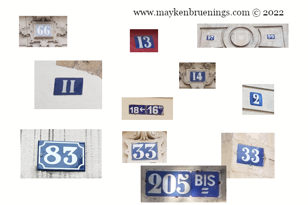
Did you know there is a logic to the street numbers in Paris? There is, and it’s really quite simple and has helped me many times in pre-cell phone days or when I am on a bike and my phone is in my pocket.
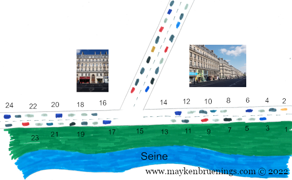
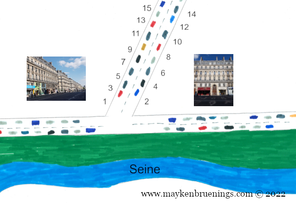
The rule is very simple and distinguishes streets running (roughly) perpendicular to the river and streets running (again, roughly) parallel to the river.
For the perpendicular streets, numbering starts on the end closest to the river. Uneven numbers are on the left, even numbers on the right. So if you’re looking for a number higher than the one in front of you, go away from the river.
For the parallel streets, numbering starts upriver. The south side of the street will have the uneven numbers, the north side the even numbers. So if you’re looking for a number higher than the one in front of you, go downriver.
Easy-peasy, right?
A street running parallel to the river – numbering starts upriverA street running perpendicular to the river – numbering starts near the river
If you come to Paris at a certain time of the year, or stay for a while and use public transport on a regular basis, you might come across some animals.
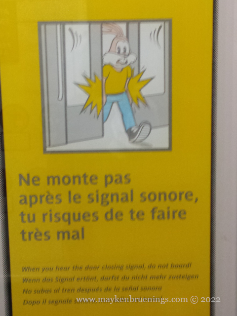
First up: Serge le lapin, the official Paris metro bunny and quite probably the stupidest and/or unluckiest bunny in France. Serge has been around for 45 years, getting his paws stuck in the sliding metro doors. I’ve also spotted him getting hurt on the escalator.
So far so good, but what are the chameleon and the beaver doing on Paris transport? I’ll let you make a guess first, just for fun.
I’m sure you didn’t get it, it’s very far-fetched.
Caméléon (chameleon) and castor (beaver) are the names of two different replacement services. Caméléon busses jump into action when one of the RATP’s ten tram lines is interrupted for one hour or more.
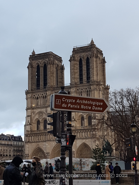
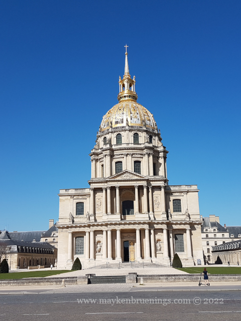
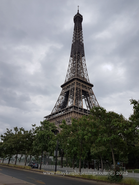
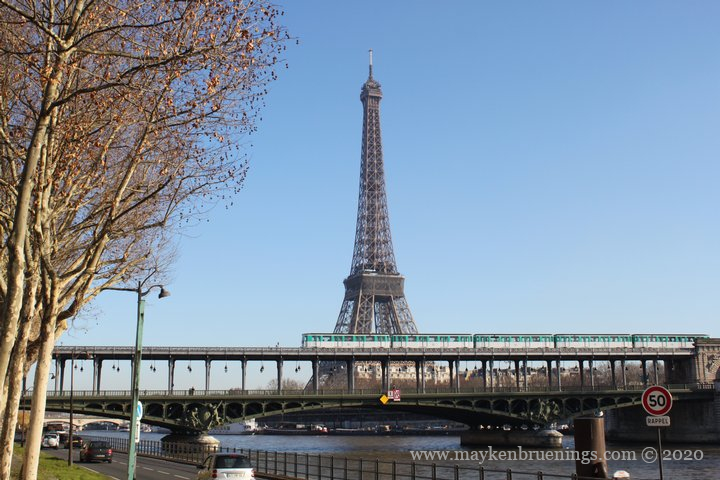
Castor (beaver) is the name of the replacement bus service for the central Paris section of the RER C train that runs along the Seine river through aging tunnels . The almost two decade long “Beaver works” project takes place every summer when the section is closed down entirely for a month or longer, and the “beaver buses” take over. Since this is high tourist season, and the closed section of the RER train includes Notre Dame, Musée d’Orsay, Invalides and the Eiffel Tower, it might actually be useful to know.
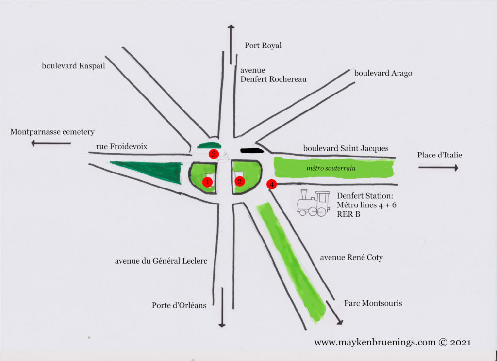
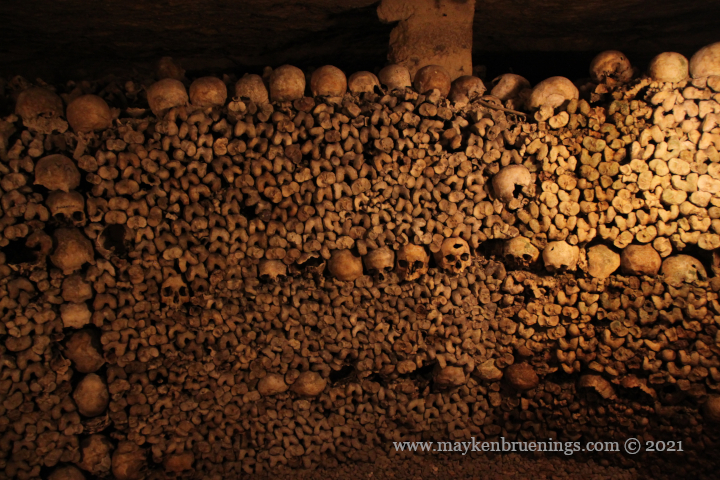
The Denfert-Rochereau intersection in the 14tharrondissement is known by tourists mainly for the entrance to the catacombs and for the departure of the airport buses to Orly airport. There is, however, a whole lot more. Let’s have a look at the intersection.
No fewer than seven streets intersect here. First, the north-south axis:
Avenue Denfert Rochereau to the north, it leads to Port Royal.
Avenue du Général Leclerc to the south, it leads to Porte d’Orléans (see also La Libération).
To the west, rue Froidevaux, which runs alongside Montparnasse cemetery in the direction of Montparnasse.
To the east, boulevard Saint Jacques which turns into boulevard Auguste Blanqui and runs towards Place d’Italie, with a partially overground stretch of metro line 6.
To the northeast, boulevard Arago, and to the southeast, along the train line, avenue René Coty, leading to the Parc Montsouris.
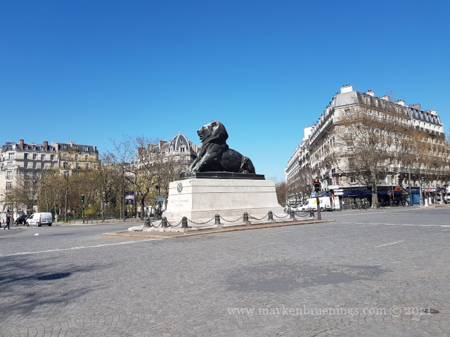
Now for the intersection itself. At its center thrones the Belfort Lion of Paris (3). It is a one-third size copper replica of the Belfort Lion, both of which were created by Auguste Bartholdi. It looks in the direction of the Statue of Liberty, also created by Bartholdi. The Belfort Lion in the city of Belfort, in eastern France, is a red sandstone monumental sculpture commemorating the heroic French resistance during the siege of Belfort during the Franco-Prussian war.
A view of the northern side of the intersection
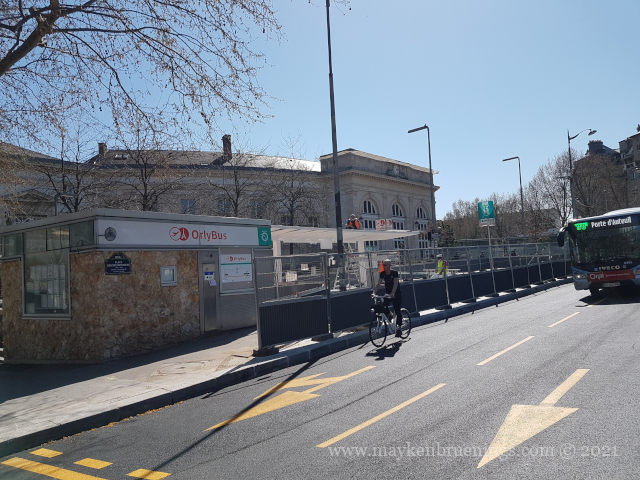
On the east side of the intersection, between Saint Jacques and René Coty, is the Denfert Rochereau station, served by metro lines 4 and 6 and the RER B which leads to both Paris airports, Roissy-Charles de Gaulle in the north and Orly in the south. Outside the station, there’s the Orly airport bus station (4).
Denfert station, currently undergoing works
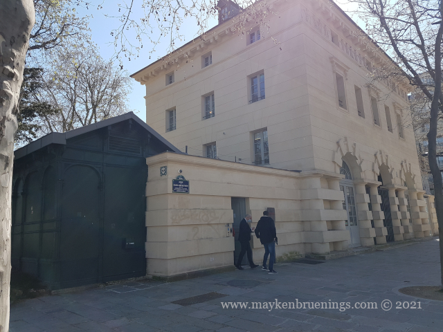
At the center of the intersection, south of the lion, the lodges of the barrière d’Enfer, an entry point of the General Farmers tax wall house two museums: the Paris catacombs on the east side (2) and the Museum of the liberation of Paris on the west side (1).
Denfert tax lodge with entrance to the Catacombs
Avenue du Colonel Henri Rol-Tanguy, tax lodges and Denfert station
The lower part of the Place Denfert was renamed in 2004 to Avenue du Colonel Henri Rol-Tanguy to honor this communist resistant (1908-2002) who led the insurrection of the capital in August 1944 from his command post in the catacombs underneath the intersection.
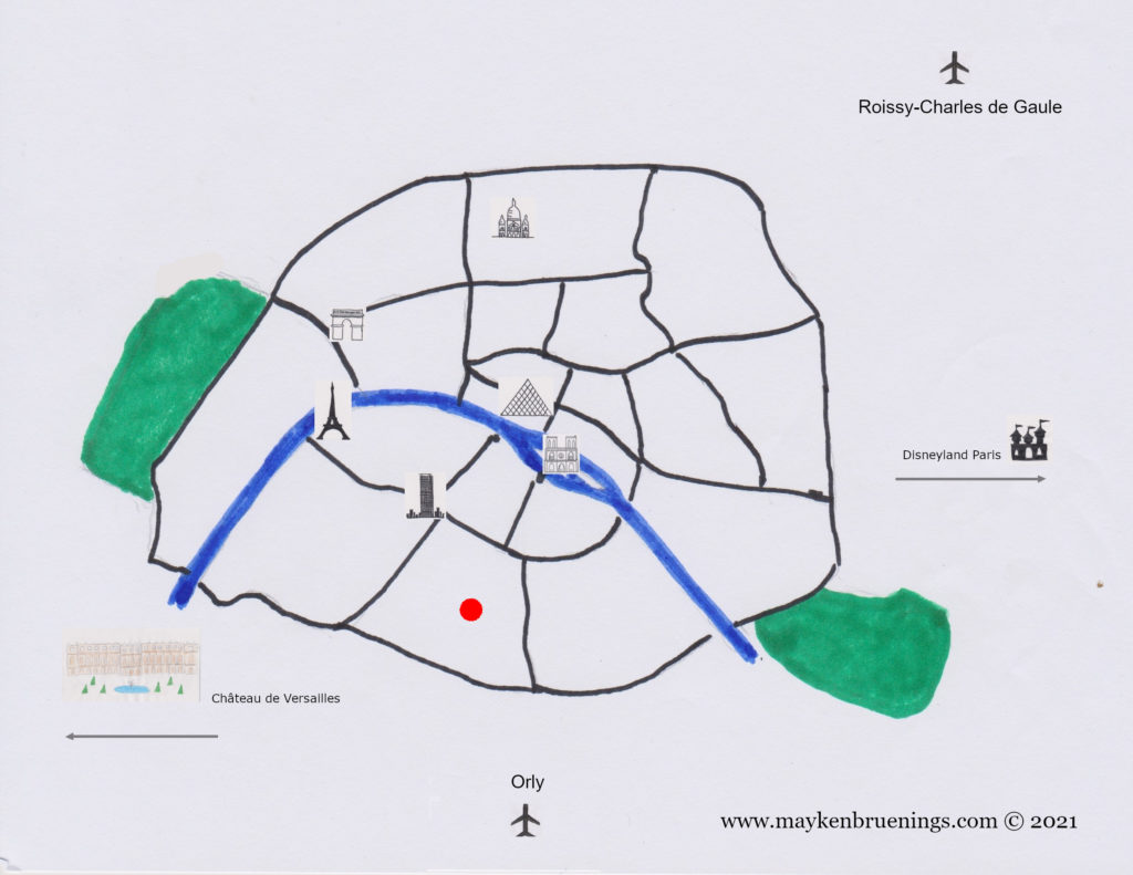
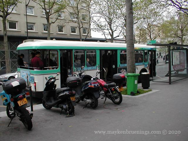
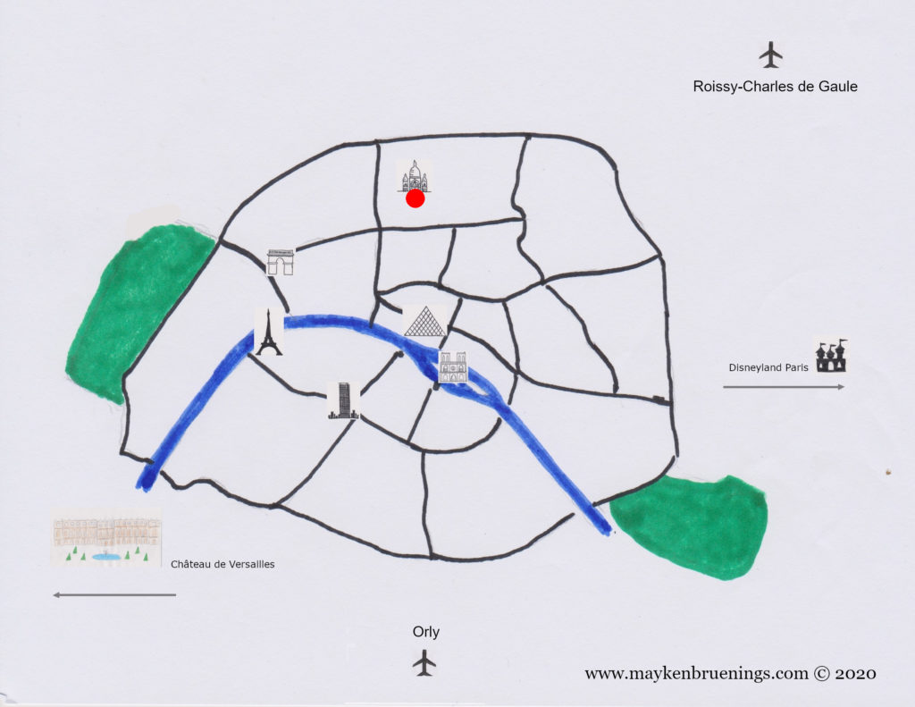
In addition to the 14 lines of the Paris subway, the Métro (from Métropolitain), several lines of RER commuter transit trains cross the city and serve the suburbs. They allow you to reach Versailles and its royal palace, Disneyland, the Stade de France, and Roissy-Charles de Gaulle airport. Paris has several recent tram lines running along the city limits or serving the outskirts, as well as many bus routes crisscrossing the city. Despite a growing number of bus lanes, buses still get stuck in traffic a lot and are not a good means of transport to get from point A to point B – unless you are there for the ride, and not the destination.
The easiest way to get from point A to a point B that is too far to walk (I assume you are here to see things) is the metro. Nowhere in Paris are you more than 500m from one of the over 300 metro stations.
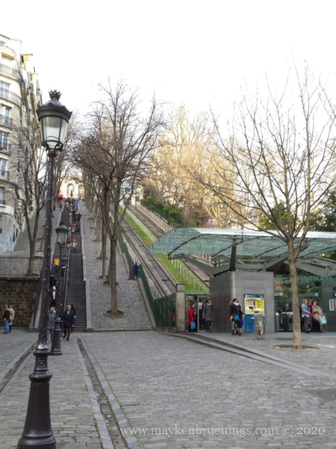
The only stations not connected to the métro/RER network are the bottom and top stations of the Montmartre Funicular.
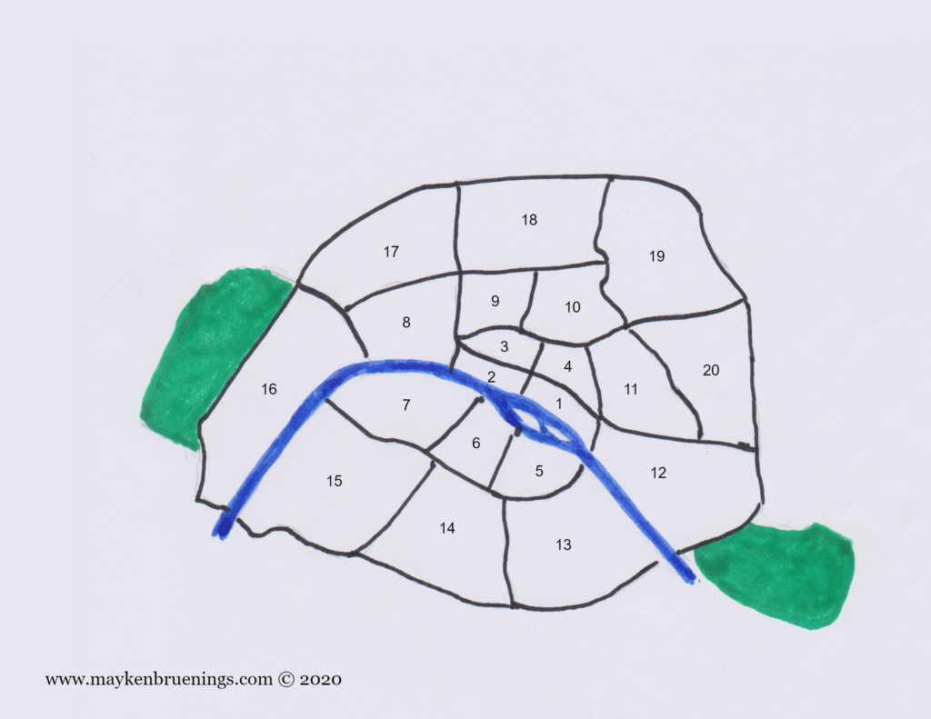
Paris, is not only a city, but also one of the 95 departments that make up mainland France. Long after the last stone wall around the city came down, the city and department limits of Paris are marked by a more modern barrier. It is the ring road called the Boulevard Périphérique, or as locals say, le Périph’, 35km long and 35m wide, built between 1956 and 1973, that now separates Paris from its suburbs, la banlieue.
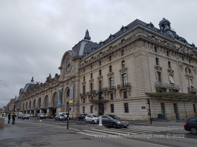
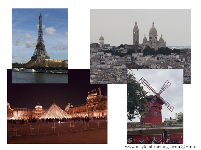
Within these city limits, the Seine river, flowing in an inversed U-shape through the city, splits Paris into a Right Bank (to the north) and a Left Bank (to the south). The Right Bank houses the business districts, the Champs Élysées, the Louvre, and Montmartre, while the Left Bank is home to the Latin Quarter with the Sorbonne University, the Musée d’Orsay, and the Eiffel Tower.
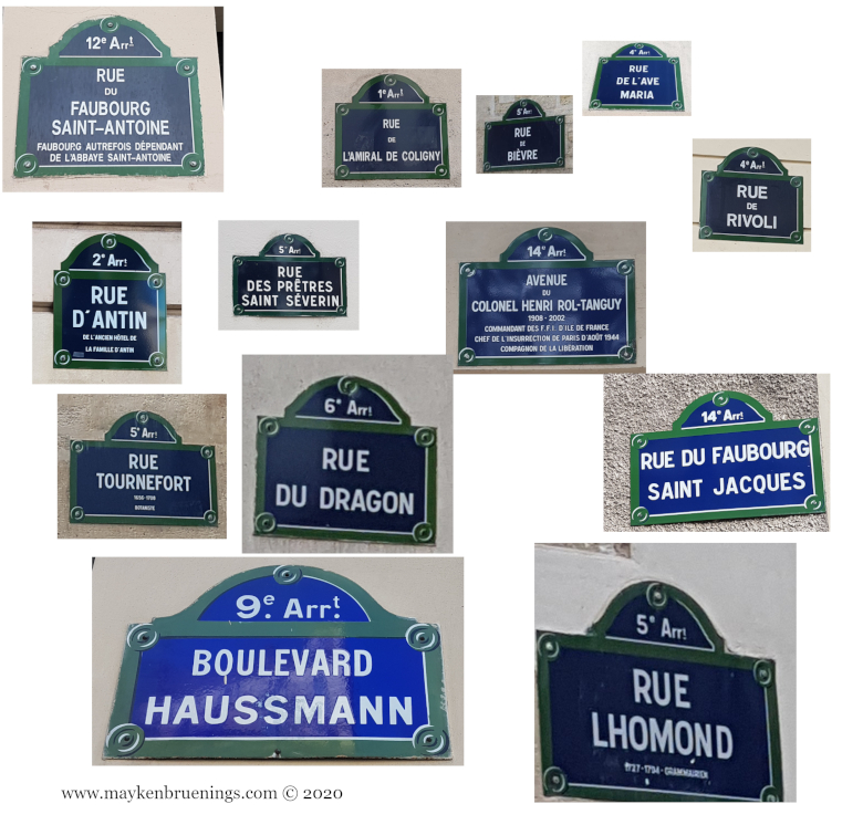
Administratively, Paris is split up into 20 districts, arrondissements, that each have their own town hall and their own mayor. They are numbered from 1 to 20, spiraling outward from the center like a snail’s shell. The Louvre is in the first district, Notre Dame in the fourth, the Sorbonne in the fifth, the Eiffel Tower in the seventh, the Champs Élysées in the eighth, the Opéra Garnier in the ninth, and so on.
If you want to know in which arrondissement you are, just look at a street sign!
The woods Bois de Boulogne to the west and Bois de Vincennes to the east, while outside the snail shell and the Périph’, belong to the city of Paris.
The business district of La Défense, on the western end of the prolongation of the Champs Élysées, on the other hand, does not. It is located in the department Hauts-de-Seine.
Fun fact about the districts: When the city grew beyond its then 12 districts in 1860, the rich western parts of the city (now the 6th district) didn’t want to become number 13. Beyond the obvious superstition, there was another reason: At the time, the expression “getting married at the town hall of the 13th district” meant living together “in sin”, as there was no 13th district with a town hall to get married in. The rich people of the west did not wish to be associated with such a repugnant idea.
Paris has six main train stations (gares), all of which are terminus stations – no rail line cuts through Paris. (RER commuter transit trains and metro subway trains run mostly underground through the city.) On the Right Bank, the Gare du Nord serves northern France, London (with the Eurostar), Belgium, the Netherlands, and northern Germany. The Gare de l’Est just a stone’s throw away, serves the east of France and southern Germany. The Gare de Lyon serves a vast area from Mulhouse to Perpignan, thus including Switzerland, Italy and the entire Mediterranean coast. On the Left Bank, the Gare d’Austerlitz serves inland destinations along the line Paris-Orléans-Limoges-Toulouse. The Gare Montparnasse serves the entire Atlantic coast up to and including Brittany, and back on the Right Bank, the Gare Saint Lazare serves Normandy.
The two main Paris airports are Orly to the south and Roissy-Charles-de-Gaulle to the north of the city.