
Every once in a while, and mostly in the winter months, Paris will get its feet wet. The city is cut into Left Bank and Right Bank (as I explain here) by the river Seine which has its source near Dijon and flows from there roughly northwest to reach the English Channel at Le Havre. Its drainage basin covers most of the north of France.
Despite the existence of several large storage reservoirs upriver of Paris built since 1950, the river has repeatedly risen to high levels in the city, especially in 1924, 1955, 1982, 1999-2000, June 2016 and January 2018.
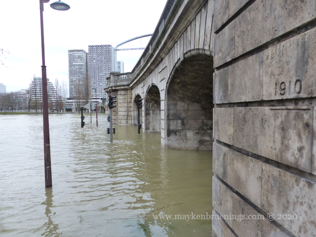
The worst flood, however, dates back to 1910 and is often qualified as a 100-year flood. Contrary to popular belief, this doesn’t mean it occurs once in a hundred years, but has a one-in-a-hundred chance of occurring in any given year.
The 1910 flood resulted from a combination of high rainfall, snow and frozen ground, flooding of several tributaries of the Seine and the already saturated underground of the Paris Basin.
Over only ten days, the Seine rose to the 8,62m level (at Pont d’Austerlitz, the official point of reference) and took 35 days to go back down, peaking on January 28. All the neighborhoods along the river were under water, and people had to use boats and wooden walkways (like you see in Venice during Aqua Alta).
On January 20, ships could no longer navigate the river in Paris because they couldn’t pass under the bridges any longer.
On January 23, the Seine reached the quay walls which had been built to the height of the 1876 flood, and parts of the city were flooded.
On January 28, peak day of the flood, some 22,000 basements and hundreds of streets were flooded with water and ice. The problem worsened as underground sewage pits that were not connected to the sewage network, polluted the water. The tankers that normally evacuate the sewage could no longer pass under the bridges, and the sanitary situation became worrying, with typhoid and scarlet fever cases.
The economy was hard hit, in particular bookstores and publishers whose entire stocks were destroyed. Some 20,000 buildings were flooded in Paris, as well as half of the existing métro network. The brand-new line 4, inaugurated only weeks earlier, is closed.
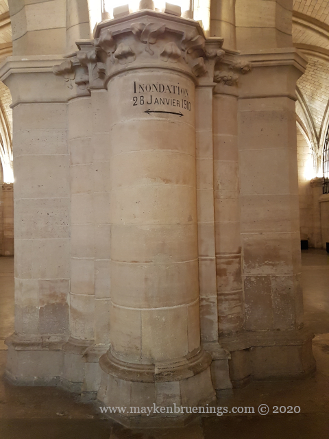
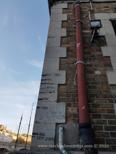
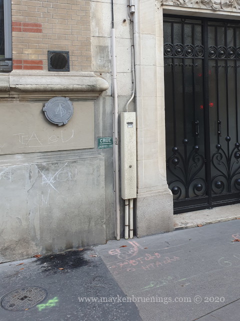
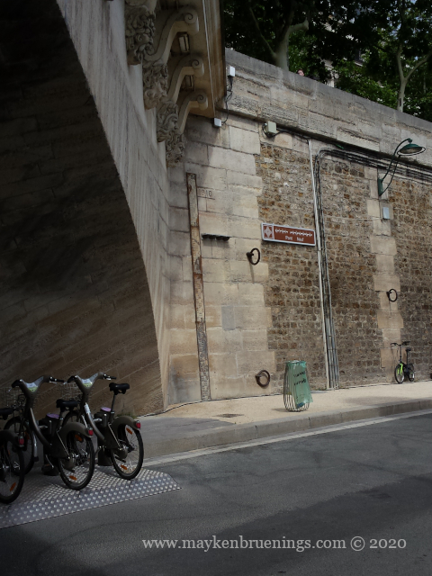
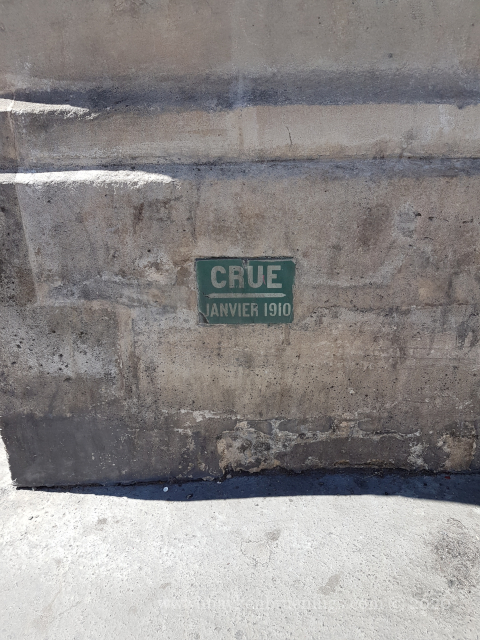
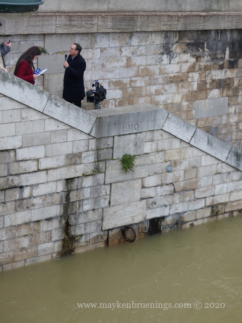
Today, the 1910 flood is the reference used for any rise of the river level. Throughout the city, you can find markers indicating the height of the 1910 flood.
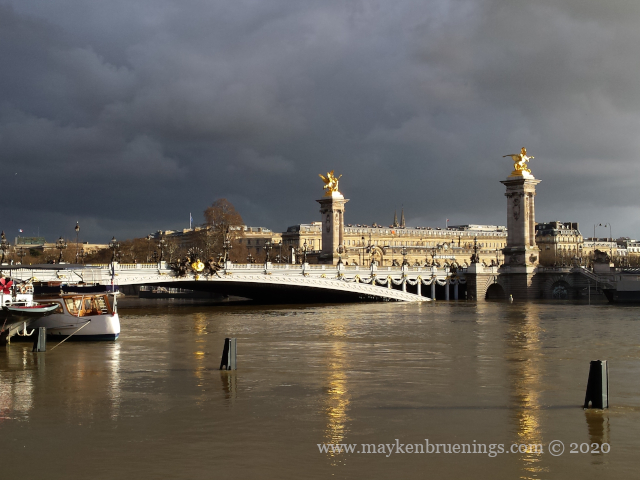
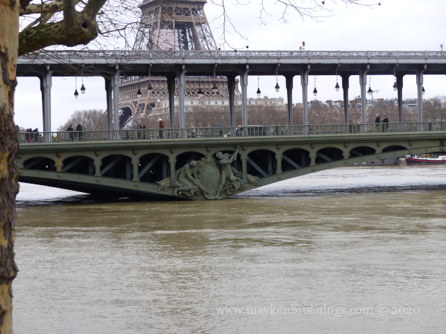
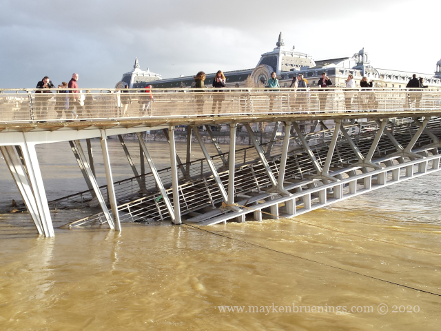
The latest two floods, in June 2016 and January 2018, made headlines around the world, and spectacular photos were posted on social networks, including by me.
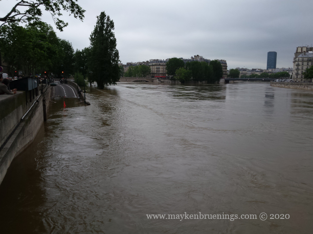
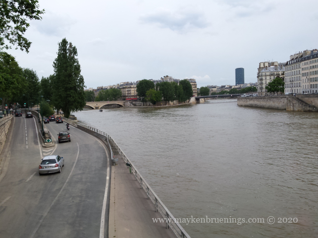
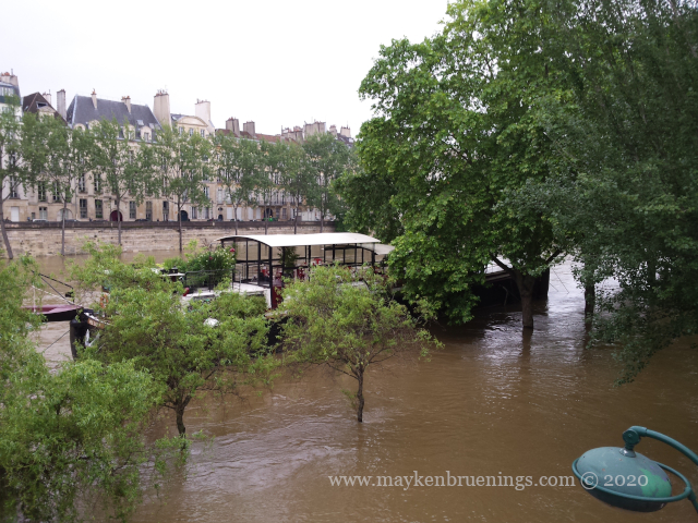
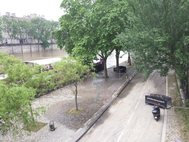
The Louvre and the Musée d’Orsay, both located on the riverbanks, closed down and transferred their underground storage items to street level for safekeeping. Still, these floods remained well below that of 1910.
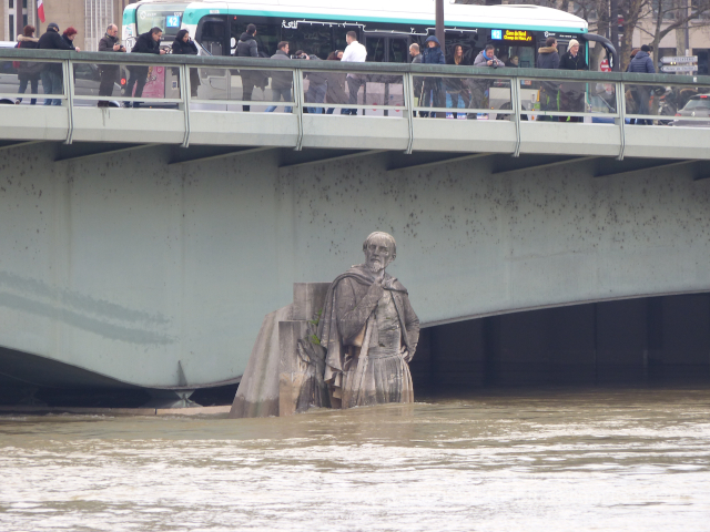
One important if unofficial reference for the level of the river is the stone statue of the Zouave on the Pont de l’Alma. It is the stone statue of a French soldier from the Zouaves, a former light infantry regiment of the French army which took their name from a North African tribe well-known for their bravery.
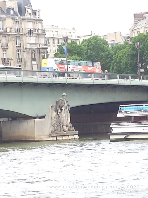
When the Seine is at its normal level, the Zouave remains completely dry. During the 1910 flood, the water reached its shoulders. When the bridge was rebuilt in the 1970s, the Zouave was moved to a lower position, making any direct comparisons impossible. However, it still remains a reference for Parisians, and it had crowds of visitors during the 2016 and 2018 floods, when the water reached up to its waist.