
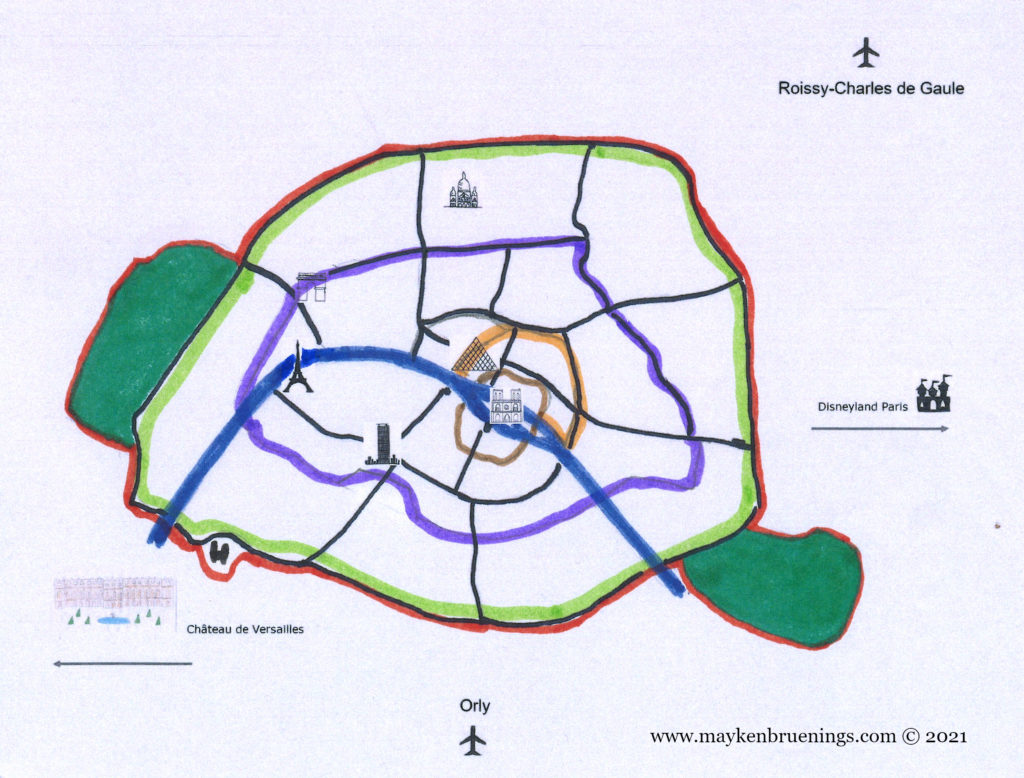
Since the first settlers built a fence around their settlement, the inhabitants of Paris have constructed walls around their habitat. As early as the 4th century CE, there were walls on Cité Island. As the city grew, new walls were erected, forming concentric circles, from Gallo-Roman times to the 21st century.
Let’s have a closer look.
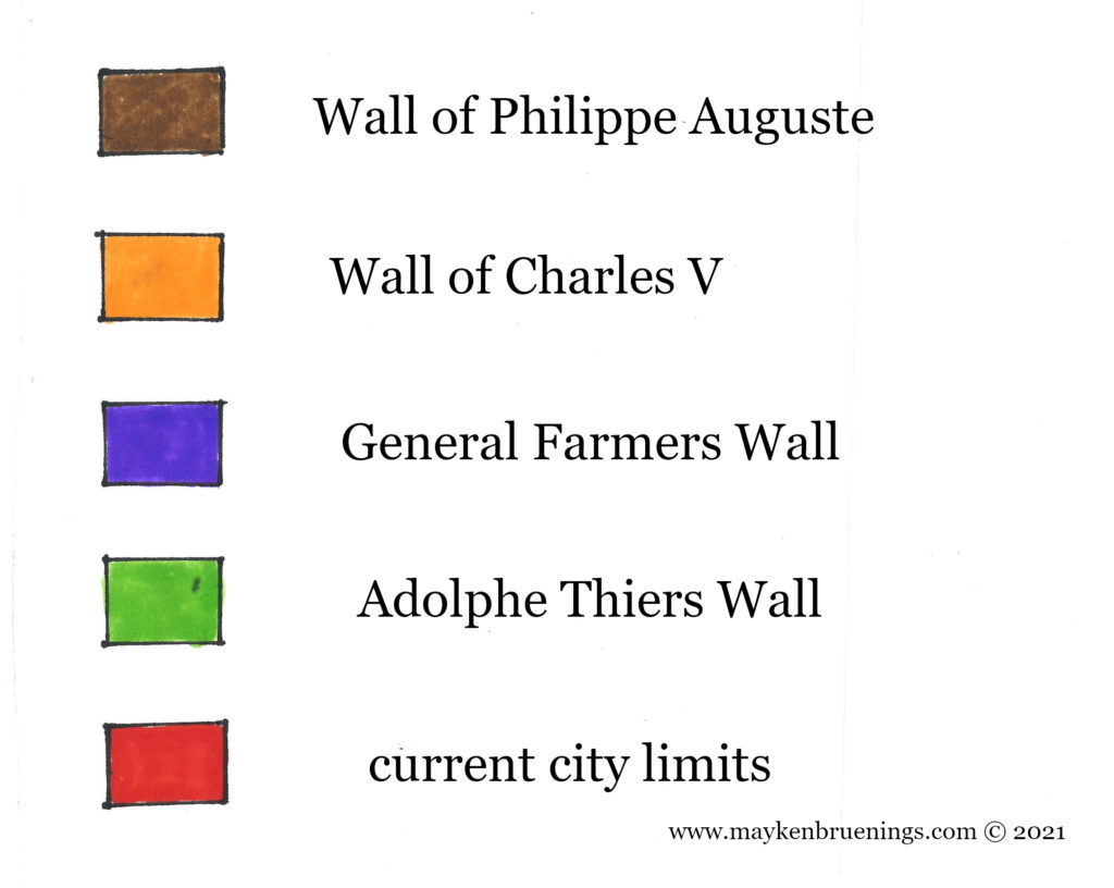
The city wall of Philippe Auguste dates back to the 13th century. Remains can be found near the Pantheon in the 5th arrondissement on the left bank, as well as in the 4th arrondissement on the right bank, in the Marais and near the Village Saint Paul.
The city wall of Charles V dates back to the 14th century. It was destroyed in the 17th century.
The General Farmers Wall was built between 1784 and 1791 by the corporation of tax farmers. It was no longer a wall to protect Paris from invaders but to collect taxes on incoming goods.
Finally, the Adolphe Thiers Wall from 1846 corresponds more or less exactly to the boulevard des Maréchaux of today.
The present-day Paris city limit lies just a little over 100m further out and is marked by the Boulevard Périphérique (“Périph” or BP) expressway, a 35km-long ring road around Paris, but also including the Bois de Boulogne to the west, the Bois de Vincennes to the east, and a heliport in the southwest, near the Seine river.
We will have a closer look at each of these walls in the following posts. Stay tuned!