In Gallo-Roman times, the population of Lutetia lived mostly on Cité Island and the south shore. There are still some remains to be seen today that will be the subject of a later blog post.
Philippe Auguste was king from 1180 to 1223 CE. He stands out among medieval kings of France for his long reign, his important military victories and his measures to reinforce the power of the king and put an end to feudalism.
4th arrondissement (Saint Paul)
4th arrondissement (Saint Paul)
5th arrondissement (Panthéon)
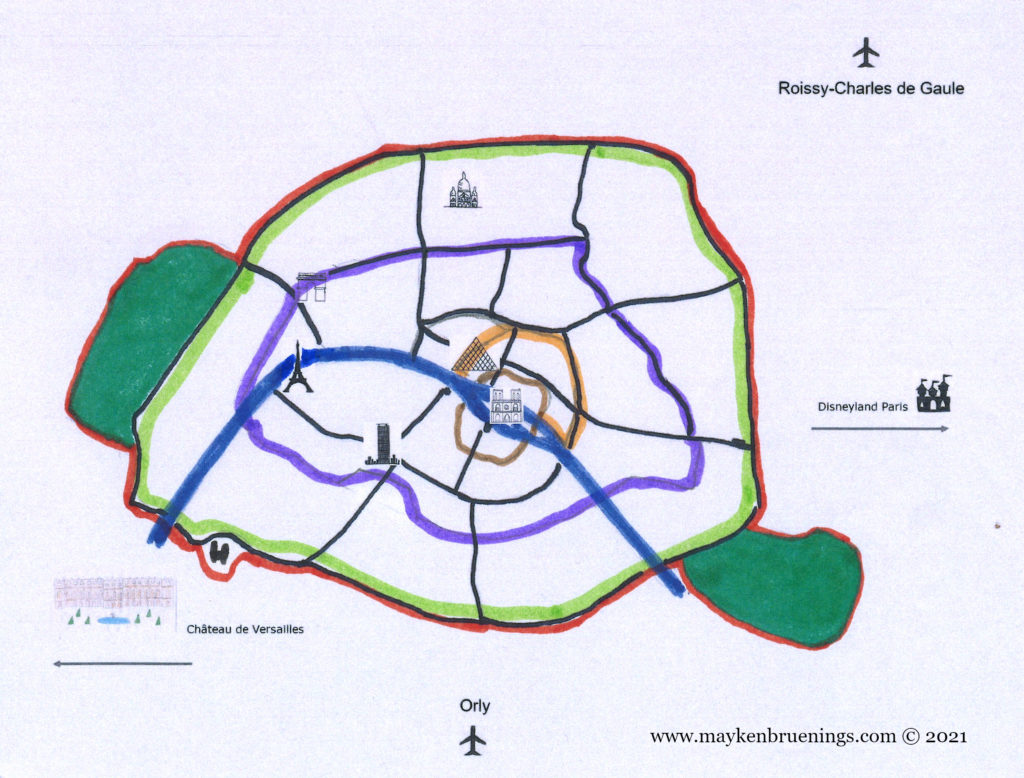
He built the city wall that bears his name to defend Paris against attacks from the English Plantagenet dynasty in particular, coming from the north and the east. It was a simple wall 5km long with 77 towers.
4th arrondissement (Marais)
4th arrondissement (Marais)
Later he also built a second portion of the wall on the left bank, after Normandy fell into the hands of the Plantagenet, and an attack from the north-west had to be envisioned.
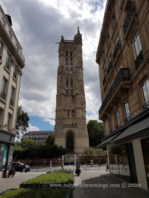
In order to protect Paris against invaders coming up the Seine river, Philippe Auguste had a fortress built, the Louvre Castle. (It was later demolished to make way for the Louvre Palace, but that’s a subject for another post.)
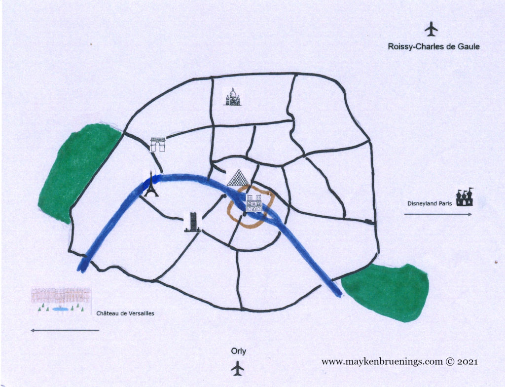
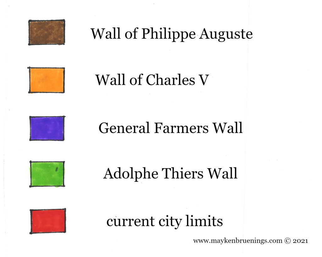
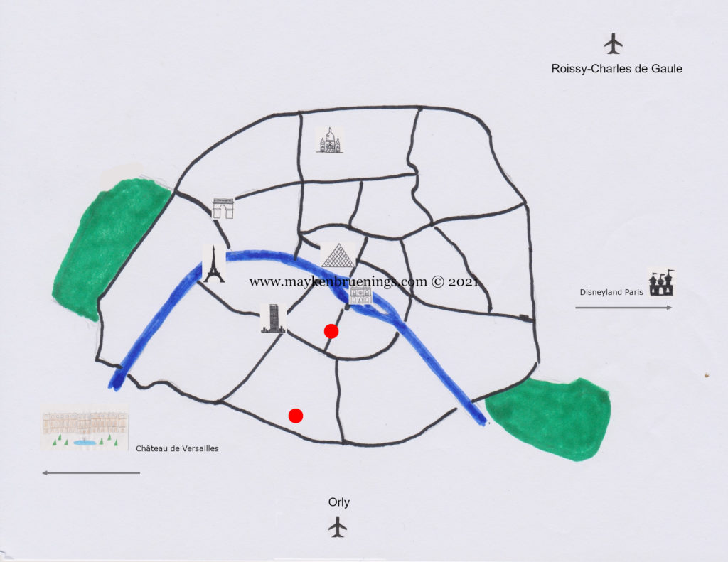
Since the first settlers built a fence around their settlement, the inhabitants of Paris have constructed walls around their habitat. As early as the 4th century CE, there were walls on Cité Island. As the city grew, new walls were erected, forming concentric circles, from Gallo-Roman times to the 21st century. Let’s have a closer look.
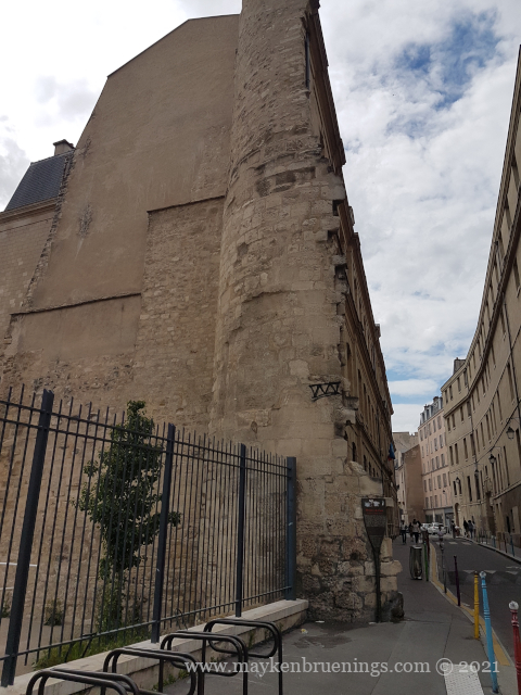
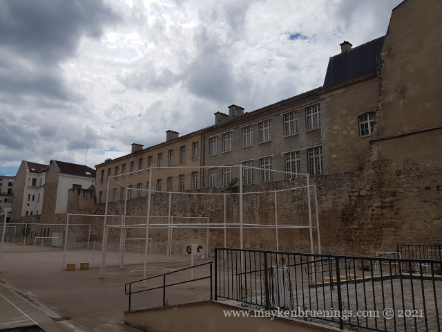
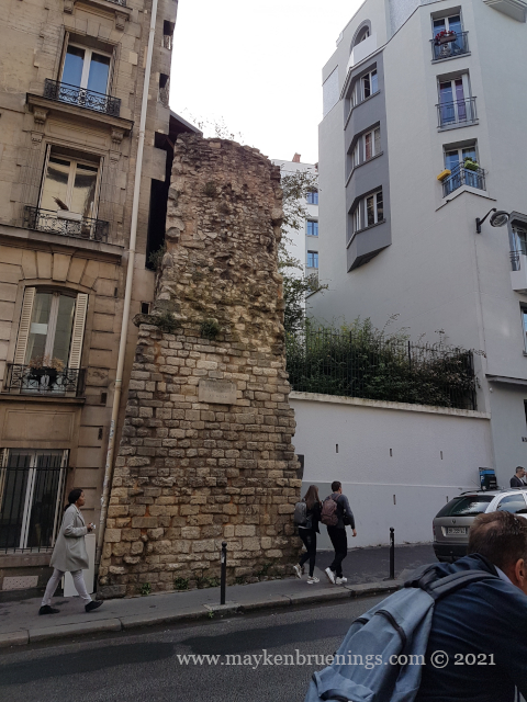
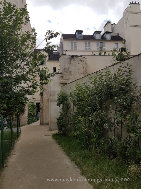
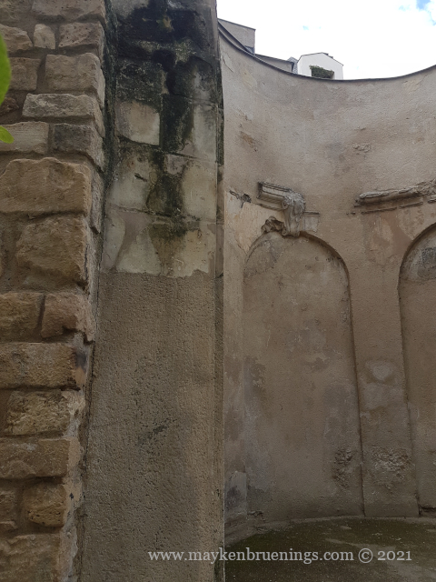
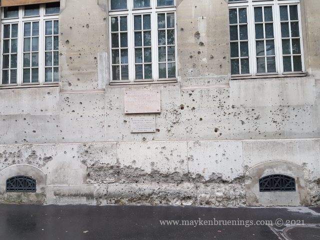
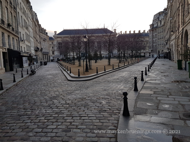
The city wall of Philippe Auguste dates back to the 13th century. Remains can be found near the Pantheon in the 5tharrondissement on the left bank, as well as in the 4tharrondissement on the right bank, in the Marais and near the Village Saint Paul.
The city wall of Charles V dates back to the 14th century. It was destroyed in the 17th century.
TheGeneral Farmers Wall was built between 1784 and 1791 by the corporation of tax farmers. It was no longer a wall to protect Paris from invaders but to collect taxes on incoming goods.
Finally, the Adolphe Thiers Wallfrom 1846 corresponds more or less exactly to the boulevard des Maréchaux of today.
The present-day Paris city limitlies just a little over 100m further out and is marked by the Boulevard Périphérique (“Périph” or BP) expressway, a 35km-long ring road around Paris, but also including the Bois de Boulogne to the west, the Bois de Vincennes to the east, and a heliport in the southwest, near the Seine river.
The evolution of Paris city walls
We will have a closer look at each of these walls in the following posts. Stay tuned!
The Latin Quarter takes its name from the shared language students from all over Europe spoke as they studied here in Medieval times. They still study at the Sorbonne and other Paris universities today, but Latin is no longer the lingua franca.
Sorbonne University in the Latin Quarter
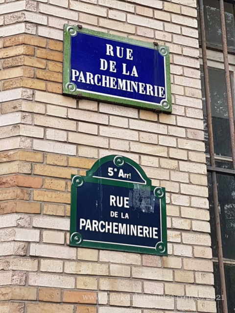
Back in the 13th century, when most people other than those students and their teachers couldn’t read or write, many public writers and manuscript-copying scribes lived in a street that took the name of “writers street”, rue des Écrivains.
In 1387, the street’s name changed to rue de la Parcheminenerie, for it was now home to parchment vendors. This coincided with a new kind of parchment, not as thick and coarse as the one used since the 7th century. It became widespread, and it was in this street that universities and students stocked up on it. In the 17th century, people still came here to stock up on books. Today the number 29 houses a Canadian bookstore.
As first a settlement and later a city, Paris has existed for over 2,000 years. History has left its marks on the city, and traces of different time periods can be found all around Paris. In non-chronological order, let’s look at some that you might have come past during a visit without knowing.
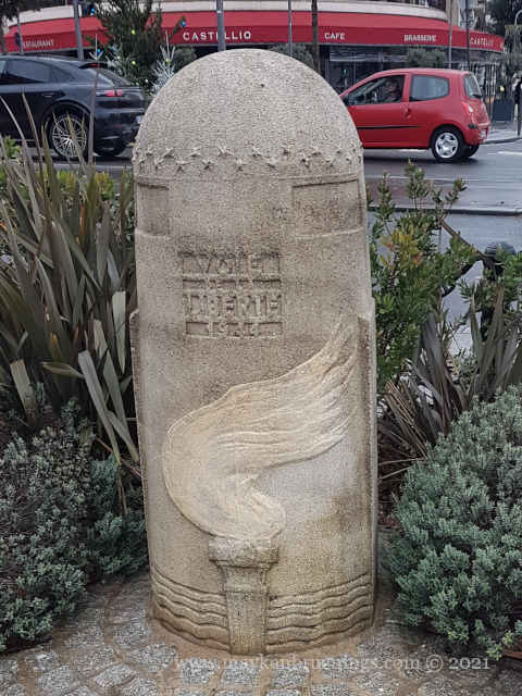
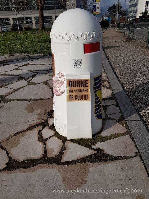
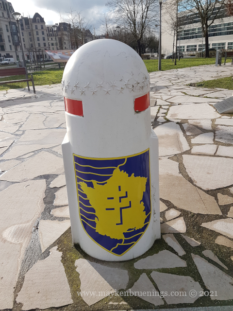
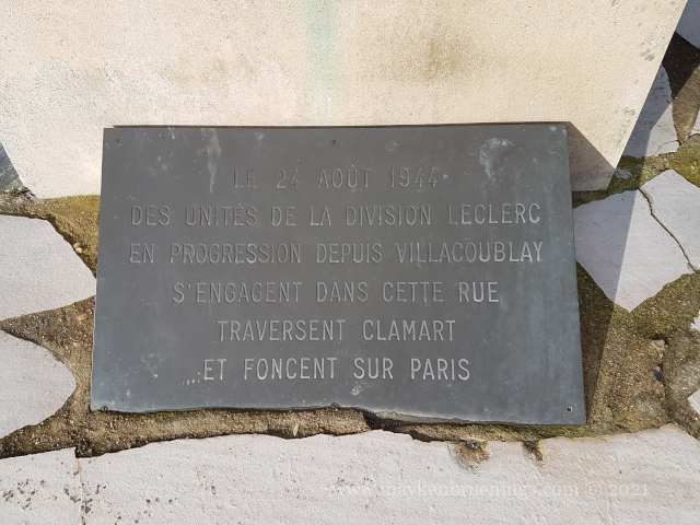
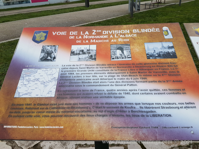
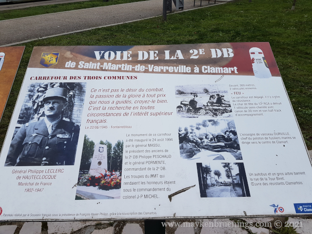
If you have been driving on the roads of northwestern France, maybe you have noticed stone markers with a flame in addition to regular distance markers. The bornes de la liberté are set along the route of the Allied Forces from D-Day in June 1944. Liberty Road (la Voie de la Liberté) starts in Normandy, travels across northern France to Metz near the German border and then northwards to Bastogne on the border of Luxemburg and Belgium. But other markers can be found outside of this main route.
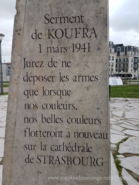
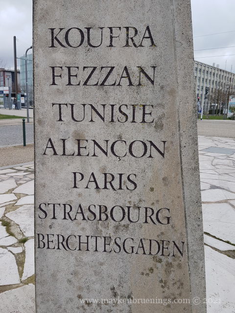
In March 1941, following the battle of Kufra in Libya, Leclerc (then a colonel) and his men swear an oath to “not put down the arm until our colours fly over the cathedral of Strasburg”. They fulfilled their oath in November of the same year. But before they could liberate Strasburg, they had to liberate Paris.
In August 1944, the Second Armored Division, in French 2e Division Blindée shortened to 2e DB, marched into Paris from the south. Commanded by the now General Leclerc, it was also called the Division Leclerc.
This monument commemorates not only the Oath of Kufra and the Liberation itself but also the events in this town the 2e DB crossed.
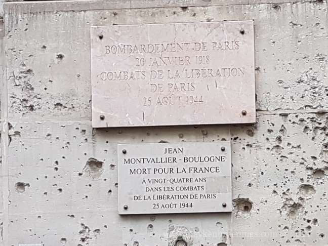
Traces of the combat in Paris in August 1944 can be found–among other places–on the wall of the Paris School of Mines on the boulevard Saint Michel (6tharrondissement, near the Luxemburg Gardens).
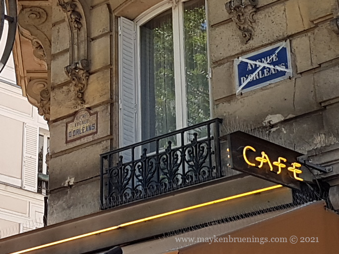
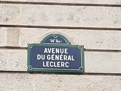
The avenue d’Orléans, in the 14tharrondissement leading from the Porte d’Orléans to the Place Denfert-Rochereau is today called Avenue du Général Leclerc.
Map of Paris showing the Avenue du Général Leclerc (the lower point) and the wall of the Paris School of Mines (the upper point).
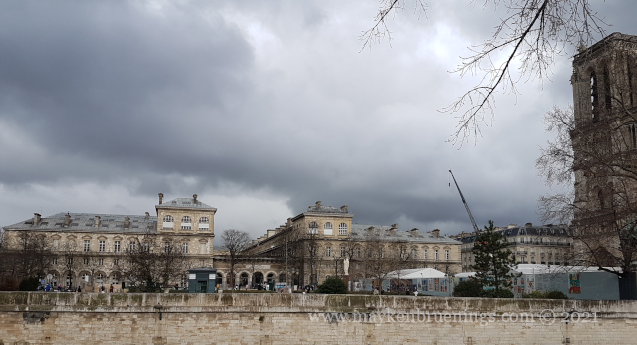
Did you know that in French, a “hotel” isn’t always a place where you can book a room for a night? A hôtel-Dieu, for example, was originally a hospital for the poor run by the Catholic Church, Dieu being the French word for God. The most famous of all these hospitals is also the oldest in Paris, created in the year 651 by the Parisian Bishop Saint Landry. Today you can find the hospital building right next to Notre Dame on Cité Island.
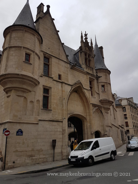
A hôtel particulier is no more a hotel than a hôtel-Dieu, but a grand townhouse or mansion. Their main characteristic is that they will be free-standing, most often located between the main courtyard and the garden, and of course, be in a city.
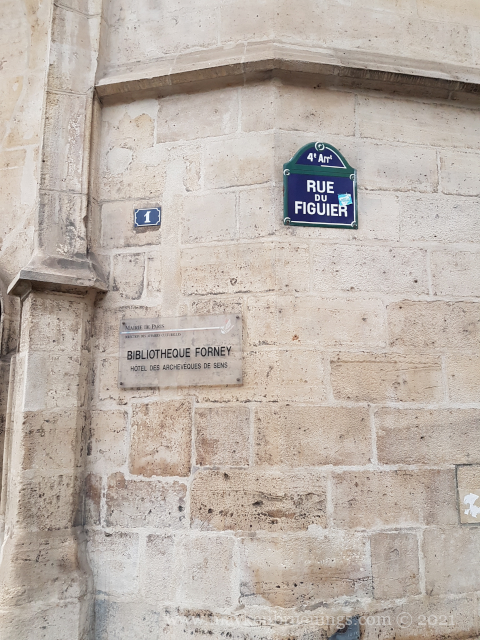
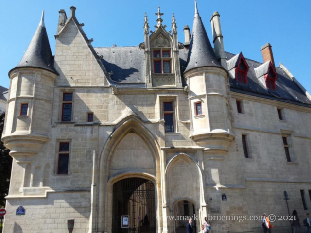
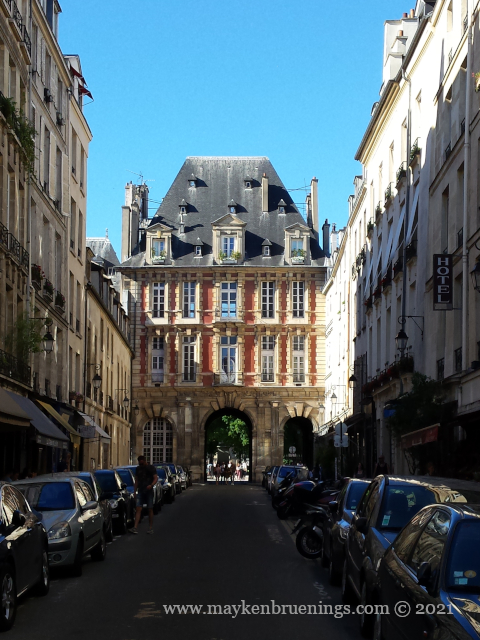
The Hôtel de Sens is a hôtel particulier built in the 15th century in the 4tharrondissement, near the Seine river. At the time, Paris did not have its own archbishop but belonged to the archbishopric of the Archbishop of Sens, a town 100km to the southeast of Paris. The archbishop had this hôtel particulier built as his pied-à-terre when he was in Paris. Several archbishops resided there, in fact, over time, as well as other notable figures such as Antoine du Prat, chancellor and prime minister under King François 1er, Louis de Bourbon-Vendôme, a prince from the royal family, or Louis de Guise, Cardinal of Lorraine.
One resident, however, had a more eventful stay than the others: Marguerite de Valois, better known as La Reine Margot (granddaughter of François 1er and first wife of King Henri IV). Her marriage with King Henri IV was annulled in 1599. She lived at the Hôtel de Sens from 1605 to 1606. Legend has it that she had a fig tree at the door cut down because it was in the way of her carriages. Whether it is true or not, the street now bears its name.
Marguerite had a number of lovers. According to another legend, two of them fought it out just below her window. One was killed, the other executed in the same spot.
Main entrance of the Hôtel de Sens on the corner of Rue du Fauconnier and Rue du Figuier
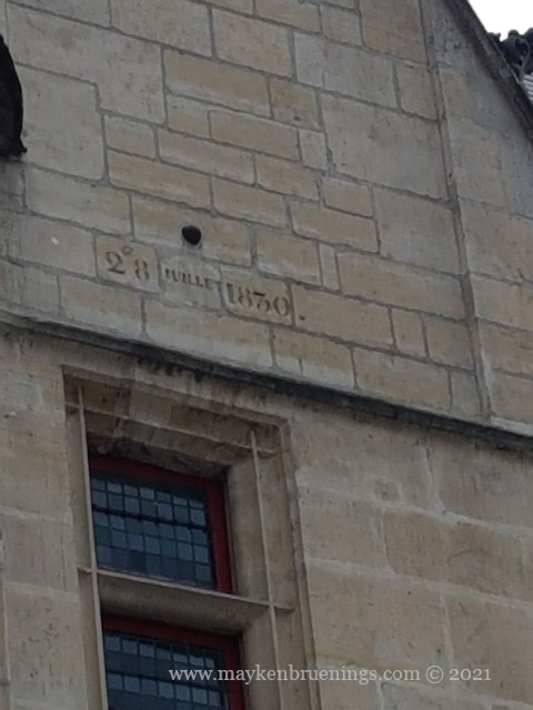
During the Revolution, the Hôtel de Sens became property of the state, was sold and housed, like many hôtels particuliers in the area at the time, shops, workshops, or factories. During the 1830 Revolution (commemorated by the July Column at Bastille), a cannonball hit the façade and lodged so deep within the wall it became impossible to remove. It is still there today, visible to any passersby, with the date engraved beneath.
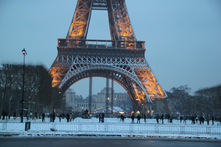
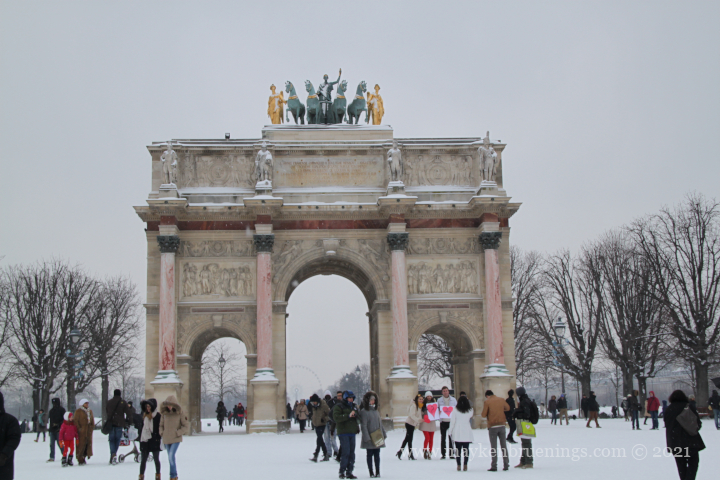
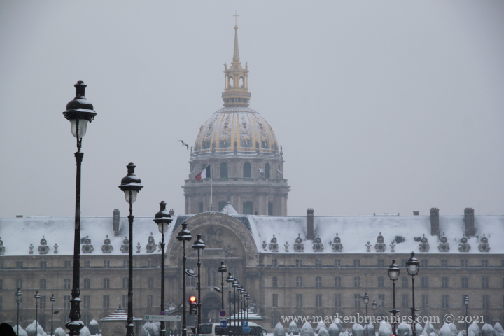
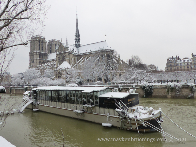
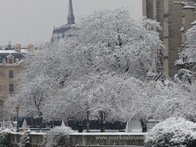
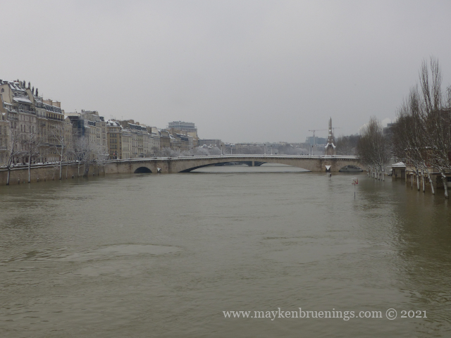
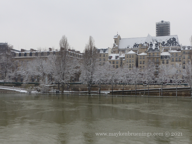
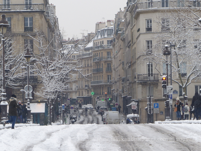
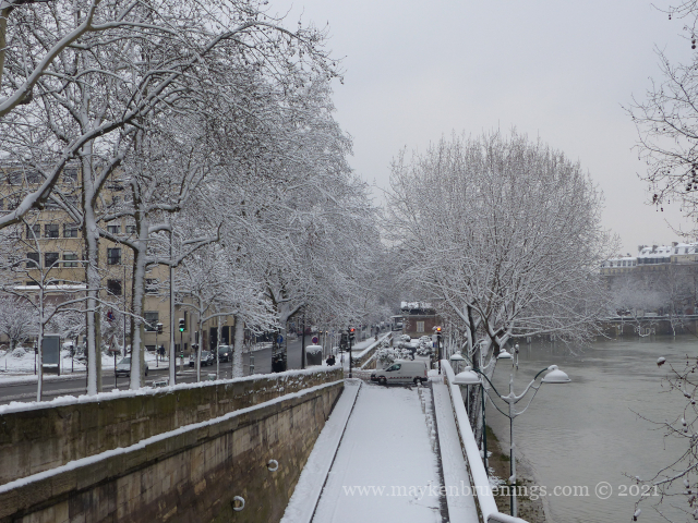
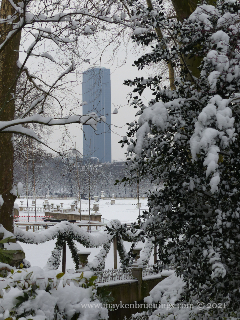
On Saturday, January 16, 2021, Paris woke up in the snow. We don’t have snow very often here, and when it falls, it rarely stays on the ground due to everything that heats up the ground, from the rarely-below-0°C temperatures to the métro and other underground installations. I’ve been living here for twenty years, and I can count the number of days where the snow actually covered the ground on my hands.
In January and March 2013, we had a bunch of snow days, and again for two days in February 2018. Every other snowfall in the last decade has been negligible. Hence the excitement of visitors, the confusion of unused-to-snow locals (without adequate footwear), the amusement of Montrealers, and the desperation of overground public transport drivers.
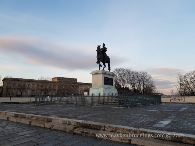
In France, and even more so in Paris, a place royale, literally a royal square, was meant to surround a royal statue, mostly an equestrian statue in the Roman tradition, but later also pedestrian statues. People could walk in the square and admire the statue of their king. There are five places royales in Paris that have undergone changes over the course of history.
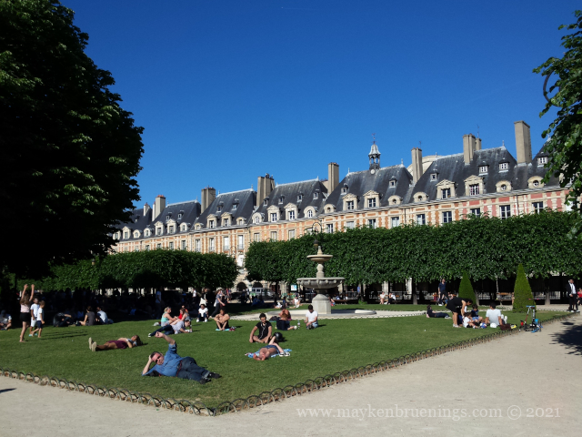
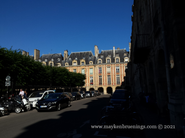
1 – Place des Vosges
Initial name: Place Royale Inauguration: 1612 Statue: Louis XIII Origin of the name: The French Département Vosges (in eastern France), was the first to pay its taxes under the French Revolution. Location: Marais, 4tharrondissement Story: Ordered by Henri IV, it was inauguration at the occasion of the engagement of Louis XIII with Anne of Austria.
2 – Place Dauphine
Inauguration: 1614 Statue: no statue in the square, but a statue of Henri IV stands in the middle of the Pont Neuf Origin of the name: Named for the Dauphin, the heir apparent, the future Louis XIII. Location: Île de la Cité, 1starrondissement Story: Created by Henri IV following the construction of the Pont Neuf. (It’s actually a triangle, by the way.)
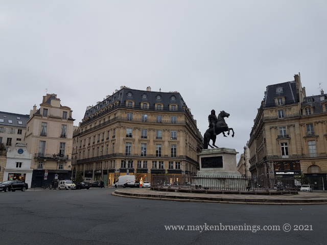
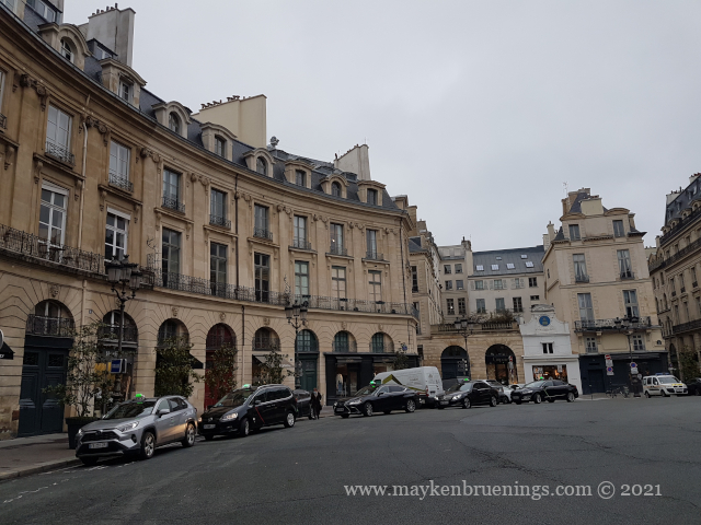
3 – Place des Victoires
Inauguration: 1686 Statue: Louis XIV as Roman Emperor Origin of the name: in celebration of the military victories of Louis XIV Location: 1st and 2ndarrondissements Story: Financed by the Duke de la Feuillade, Marshal of France, it is the first square created by a private individual to celebrate his sovereign. (Also it is actually a circle, not a square.)
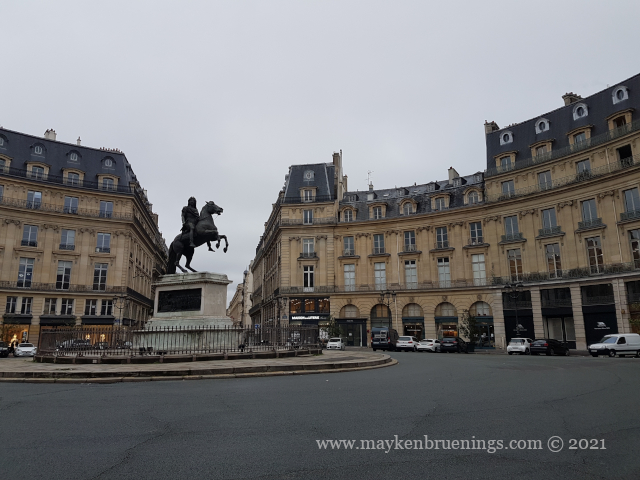
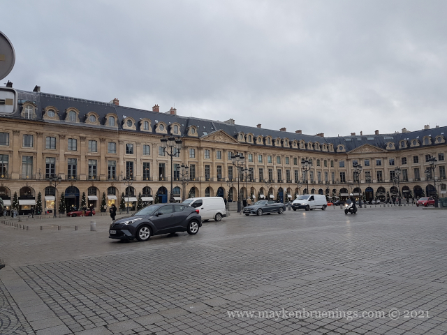
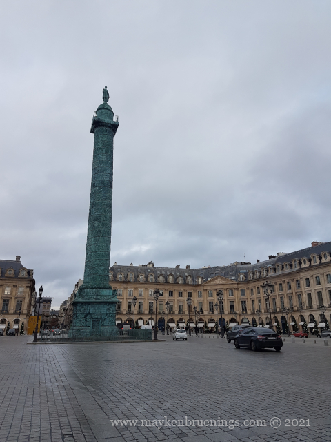
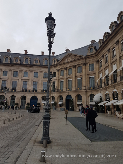
4 – Place Vendôme
Initial name: Place Louis Le Grand (Louis XIV) Other names: Place des Conquêtes (Conquests Square), and during the Revolution, Place des Piques (Pike Square, from the pikes on which were displayed the heads of the beheaded by the guillotine) Inauguration: 1699 Statue: initially Louis XIV (destroyed in 1792), presently Napoléon Ier at the top of the column Origin of the current name: The square was built in the place of the Hôtel de Vendôme, a hôtel particulier or townhouse. Location: 1starrondissement between rue de la Paix and the Tuileries Gardens Story: Initiated by Louis XIV, his grand project never saw the light of day. In the end, the square was built by the City of Paris. One of its prestigious addresses houses the Ritz.
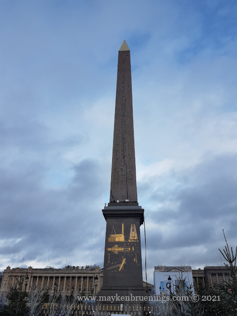
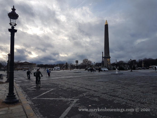
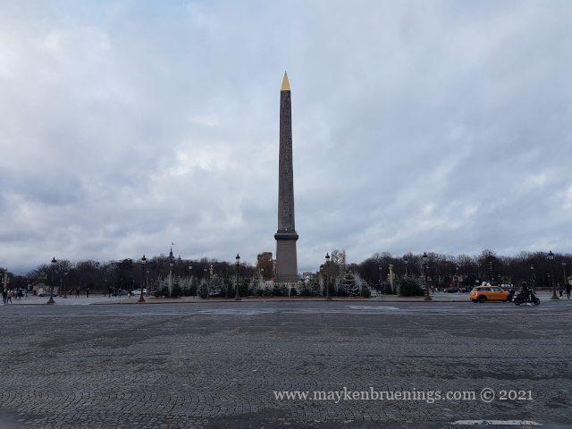
5 – Place de la Concorde
Initial name: Place Louis XV Other name: Place de la Révolution Inauguration: 1772 Statue: Louis XV, destroyed and replaced by the Egyptian obelisk Origin of the name: Reconciliation of the French people at the end of the Terror (bloody period during the French Revolution) Location: 8tharrondissement, between the Tuileries Gardens and the Champs-Élysées, on the “royal axis” Story: During the Terror, it was the location of the guillotine where among many others, King Louis XVI and Queen Marie-Antoinette were beheaded.
You might know Nicolas Flamel from fiction stories or movies, where he is portrayed as an immortal alchemist who discovered the philosopher’s stone. But did you know Nicolas Flamel was a real-life person? Most facts about him are debated and vary from one source to another, so I’ll stick with the key points.
Nicolas Flamel’s birth year and place are uncertain, but he was probably born around 1340 in the Paris area. He died on March 22, 1418 in Paris. As a child, he was lucky enough not to die of the plague, which in 1348 killed between a third and half of the European population.
In the days long before the printing press was invented, Nicolas Flamel began his career as a public writer in a small single-story house in the rue des Écrivains, Writers Street. This street disappeared when the central east-west axis rue de Rivoli was created in the 1800s.
Nicolas Flamel married Pernelle, twice widowed, with whom he opened a small shop near the church Saint Jacques de la Boucherie, and a workshop nearby specialized in precious manuscripts. He financed the construction of a doorway of the Saint Jacques de la Boucherie church, the arcade of which showed him with Pernelle. Today, only the Tour Saint Jacques remains of this church, a tower which was built a hundred years later.
The Tour Saint Jacques seen from Rue Nicolas Flamel
It was often speculated how the Flamels acquired their wealth, and Nicolas was rumored to be a successful alchemist. In reality, Pernelle brought money into the marriage from her previous two husbands, and Nicolas had a successful career as a scribe and bookseller. He also owned several houses in Paris and its suburbs, real estate investments that in the economic depression of the Hundred Year War contributed to his wealth.
They contributed financially to churches, and Nicolas continued to do so after Pernelle’s death in 1397. He had several houses built to house the poor. The only one still in existence is located at 51 rue de Montmorency (3rdarrondissement) and is said to be one of the oldest stone houses in Paris.
Nicolas Flamel died in 1418 and was buried in the church Saint Jacques de la Boucherie. His bones, together with Pernelle’s, were later transferred to the Catacombs. His tombstone can be seen in the National Museum of the Middle Ages – Musée Cluny in Paris.
location of Rue Nicolas Flamel and Maison Nicolas Flamel
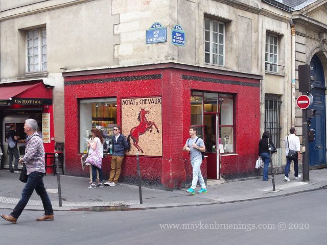
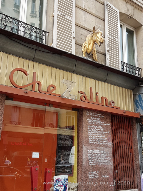
You might know this: You come back into a neighborhood where you haven’t been for a while, and a shop you remember has changed. The cute little tearoom has become a shoe store, or the flower shop has been transformed into a bookstore. Sometimes I come across shops where you can see what they used to be – generally something very different. Let me show you some of them.
This place in the Marais neighborhood (4tharrondissement) used to buy horses, as “achat de chevaux” indicates, certainly to transform them into meat which would have been sold at a horse butcher’s, a boucherie chevaline, recognizable by the horse head over the entrance.
This former Hamman (also in the Marais) now houses a fashion store on the ground floor, just like this bakery.
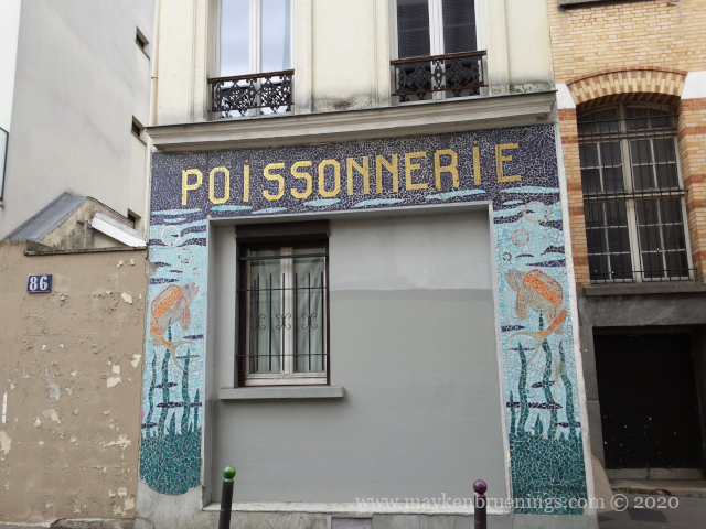
Here we have a former fishmonger’s that clearly doesn’t sell anything any longer.
This fishmonger’s, on the other hand, seems to have traded the sale of poissons, fish, for the sale of boissons, drinks.
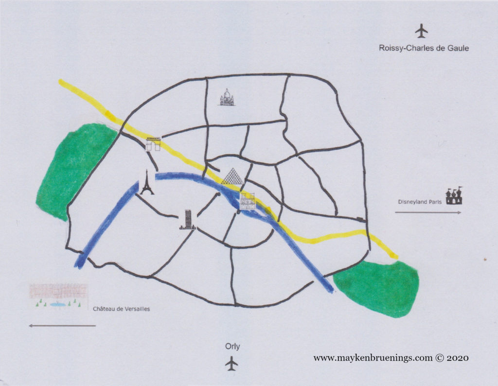
The first métro line in Paris was opened for the 1900 world fair. It ran from Porte de Vincennes on the eastern city limits to Porte Maillot on the western end and linked the different sites of the world fair as well as the Olympic games sites in the Bois de Vincennes. Today, it runs as far west as the La Défense business district which is outside the city limits.
Line 1 runs pretty much straight east-west on the historic axis of Paris, including the Avenue des Champs Élysées.
It crosses every other metro line except for the 3 and the 10 and is the most used, both by locals and by tourists, serving notably the Louvre, the Arc de Triomphe, and the Champs Élysées.
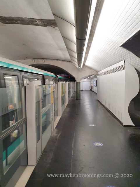
Built in part under the open sky, notably under the rue de Rivoli and the Champs Élysées, the corresponding stations are boxes the width of the street. Their walls are practically on the same level as the foundations of the buildings above.
Under the street…
…the métro station.
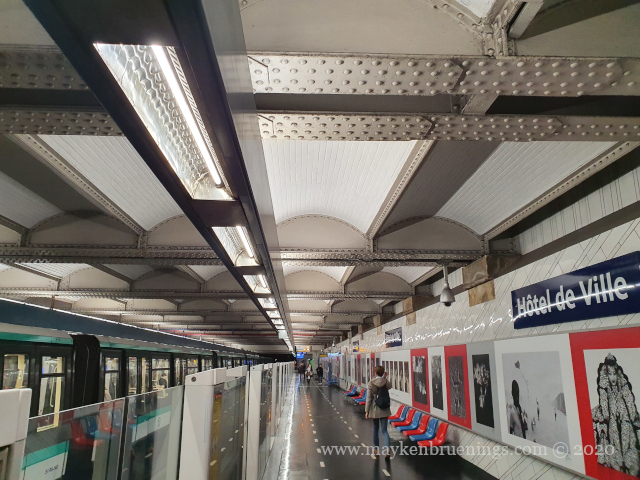
The boxes were covered with a roof, as above at the Hôtel de Ville station with steel bars and rivets.
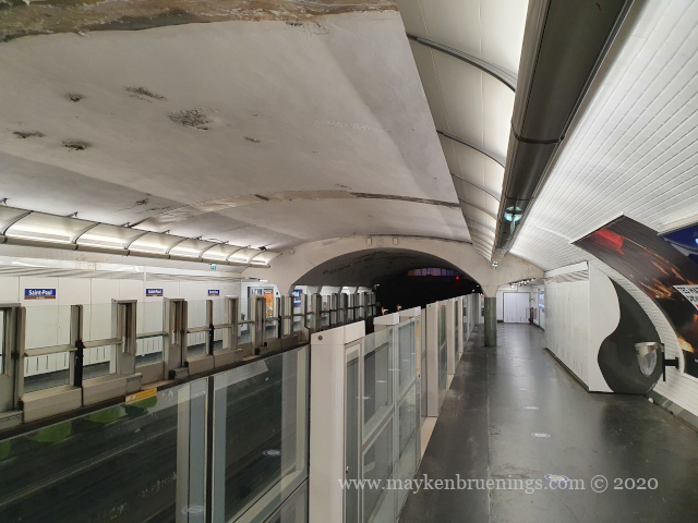
When the metro trains were lengthened from 5 to 6 cars, the platforms had to be extended as well, from 75 to 90m. In stations with fewer passengers, they simply dug into the tunnels, as at the far end of Saint Paul station below.
Since 2013, the line 1 is entirely automatic. In order to avoid any accidents or suicide attempts, all stations have glass walls along the entire length of the platform. There is no driver and you can stand at the head of the train. Let me take you on a ride.