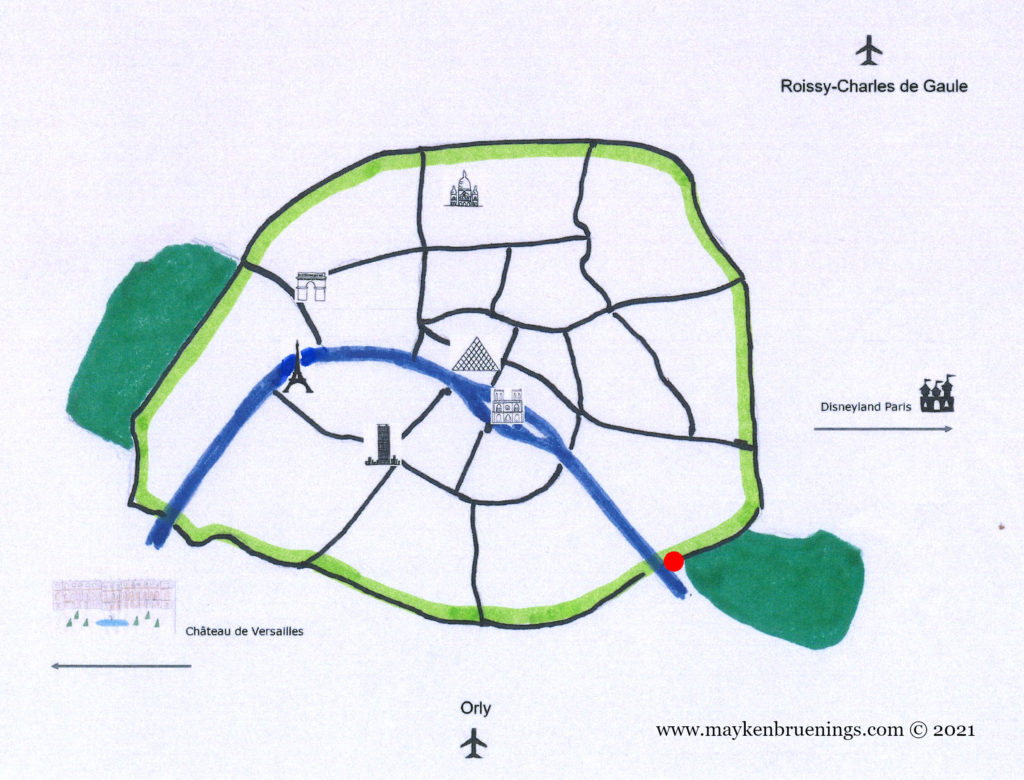
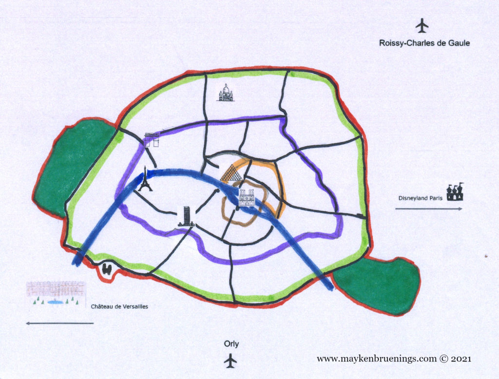
The final city wall that was an actual wall was built between 1841 and 1844 on the orders of Adolphe Thiers, President of the Council, a position that corresponded to that of Prime Minister. It ran around the entire city, a space of almost 80km² and followed the boulevards des Maréchaux, a 33,7km-long ring road named after Marshals of the First French Empire that circles Paris and can today be traced by the PC (Petite Ceinture) buses (west) and the tram lines T3A (south and east) and T3B (east and north).
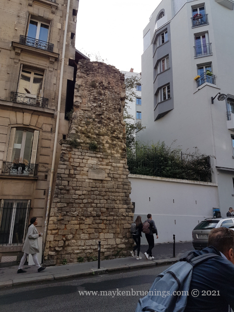
It was destroyed between 1919 and 1929, and only very few short sections remain, such as Bastion 44 in the rue du Bastion in the 17tharrondissement, the Poterne des Peupliers (a postern) in the 13tharrondissement or Bastion 1 at Porte de Bercy in the 12tharrondissement, in the middle of the Bercy interchange.
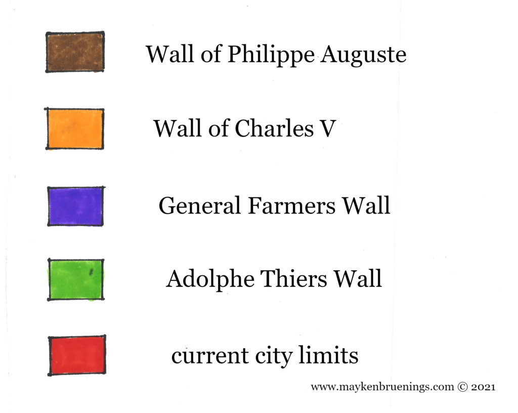
The Adolphe Thiers wall (in light green) and the location of Bastion n° 1
Who brings the Easter eggs where you live? I’ve grown up with the trusty Easter bunny, but when I came to France, I found to my surprise that the bunny is only a recent “import” and that traditionally, the Easter eggs are brought by someone else. Seeing chocolate chicken in stores along with eggs and bunnies, you might be tempted to guess the French have kept it realistic and told their kids the Easter hen brings the eggs. But that’s not what it is at all!
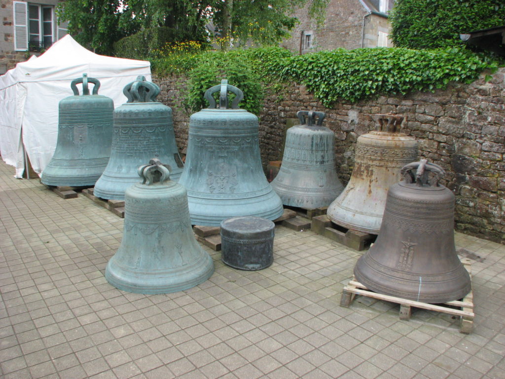
In France, the Easter eggs are brought by the church bells on their return from Rome.
traveling church bells
You see, after Holy Thursday, French church bells go silent until Easter Sunday, to mark the mourning for Jesus Christ, a Catholic tradition that goes back several centuries. Children are told the bells go to Rome, to get blessed by the Pope, and upon their return, they bring the eggs and hide them for the children to find.
The Pope, ready to bless church bells?
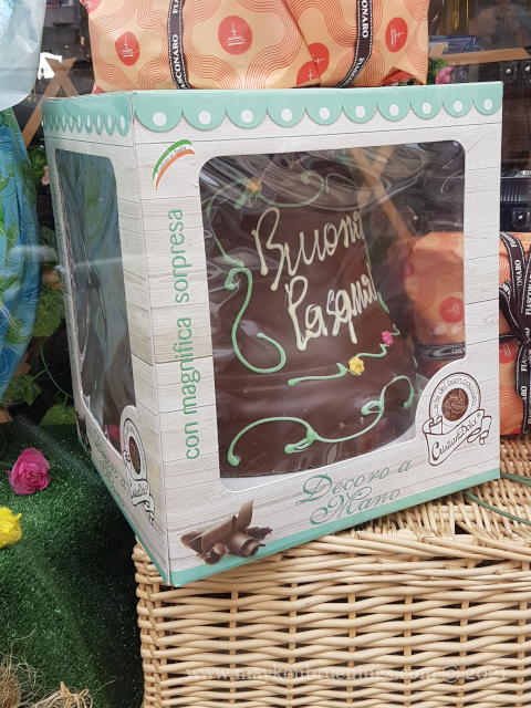
Hence the chocolate bells you will find in French (and also Italian) stores alongside eggs, hens, and Easter bunnies.
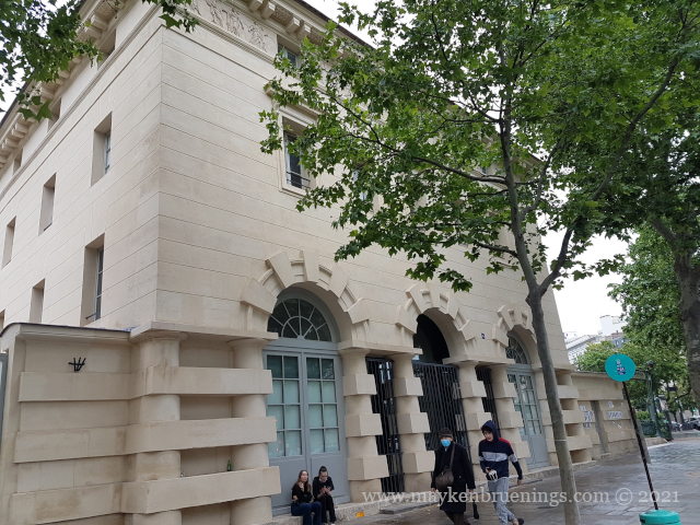
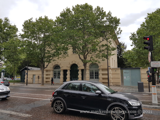
The Ferme Générale was an outsourced customs, excise and tax collection operation created under King Louis XIV in 1681. It taxed goods coming into the city in the name of the king. Between 1784 and 1791, it built a 5m-high and 25 long wall around the city that was not meant to protect against invaders but to prevent any merchandise to enter the city without paying taxes. However, smugglers used the old quarries running under the wall in what is today the 14tharrondissement.
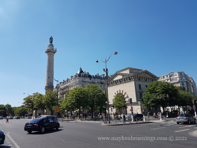
The Barrière d’Enfer lodges at Place Denfert-Rochereau
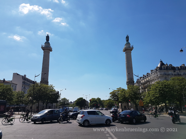
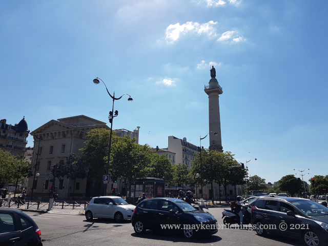
Two entry points of this tax wall can still be seen today: the lodges of the barrière d’Enfer at Denfert-Rochereau in the south (14tharrondissement), and the barrière du Trône at Place de la Nation (11th/12tharrondissements) to the east.
The Barrière du Trôme at Place de la Nation
The Barrière du Trôme lodges at Nation
The General Farmers Wall (in purple) and the location of the d’Enfer and Trône lodges
In the 14th century, King Charles V had a new wall built on the right bank but the Philippe Auguste wall was not demolished for all that, since it was considered so solid and wide that a cart could run on top of it.
Charles V was king of France from 1364 to 1380. His reign marks the end of the first part of the Hundred Years War, as he recovered almost all of the lands lost by his predecessors. He was a learned king who founded the first royal library, predecessor to the French National Library (Bibliothèque Nationale de France).
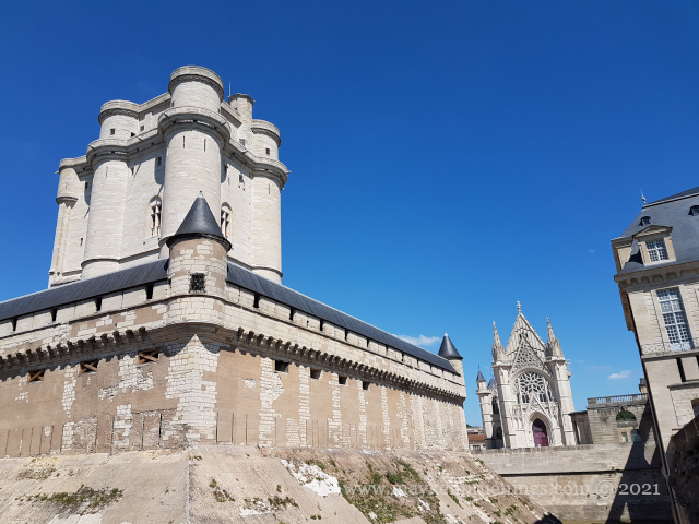
In 1356, Étienne Marcel, Prévôt des Marchands (a position similar to that of a mayor) had a new wall constructed on the right bank, however, he died before the works were completed. Charles V continued the fortification works following his tactics of terre déserte (“better a crushed land than a lost land”) and reinforced the Philippe Auguste wall on the left bank while creating a whole new wall on the right bank that was 5km long and consisted of a combination of ditches and earth-filled ramparts, the last of which was crowned by a small wall. The fortification extended beyond the Louvre Castle to the west, which made the castle lose its protective function. In the east, however, the residence of the king, the Hôtel Saint Pol, was poorly protected and therefore another small bastion was built: the Bastille. It protected against invasions through the Porte Sainte Antoine gate, and in case of an insurrection within Paris, it covered the road leading to the Château de Vincennes, the king’s residence outside of Paris.
The Château de Vincennes
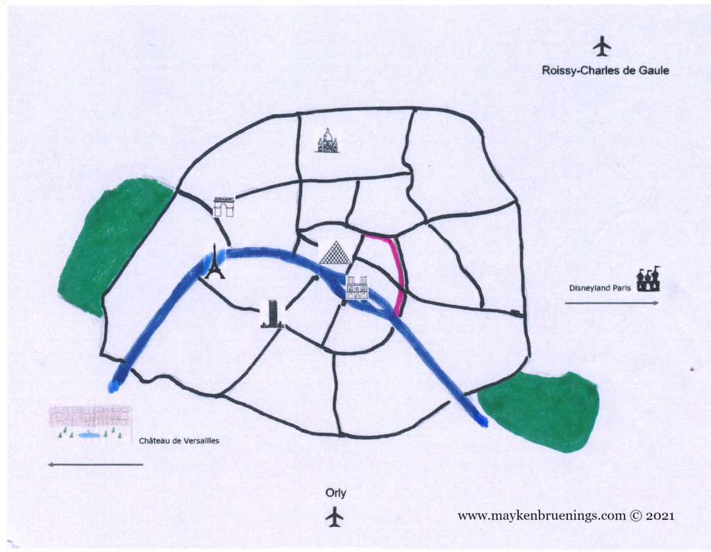
The Charles V wall was destroyed in the 17th century, and there are few remains today. However, it left its imprint on the map of the city, as many boulevards run along the site of the fortification, such as boulevard Saint Denis, boulevard Saint Martin, boulevard du Temple, boulevard des Filles-du-Calvaire, boulevard Beaumarchais and boulevard Bourdon, to name only a few.
The purple line shows the boulevards named above – running along the Charles V wall (see map below).
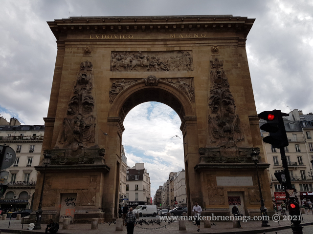
In 1672, Louis XIV, the Sun King, had a triumphal arch built on the site of one of the former wall’s gates, the Porte Saint Denis. Two years later, he had another triumphal arch built about 250m away, the Porte Saint Martin. The names are misleading since neither of them was ever meant to be a gate, but to glorify Louis XIV and his military victories.
Porte Saint Denis
Porte Saint Martin
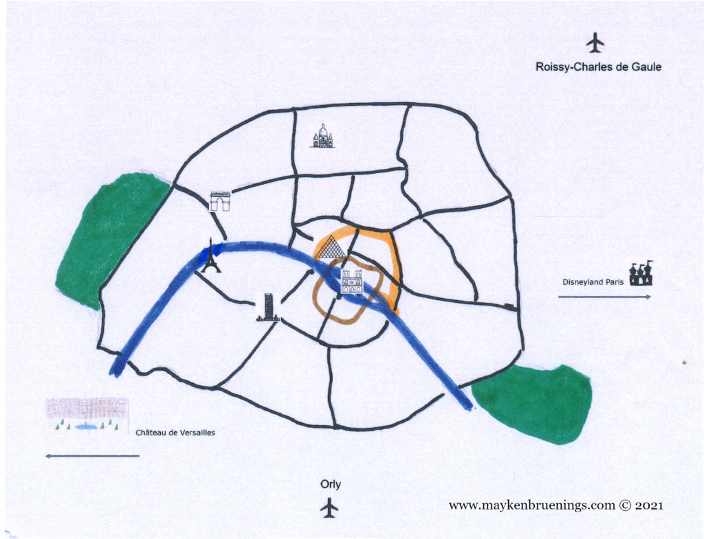
Charles V wall (orange) and Philippe Auguste wall (brown)
In Gallo-Roman times, the population of Lutetia lived mostly on Cité Island and the south shore. There are still some remains to be seen today that will be the subject of a later blog post.
Philippe Auguste was king from 1180 to 1223 CE. He stands out among medieval kings of France for his long reign, his important military victories and his measures to reinforce the power of the king and put an end to feudalism.
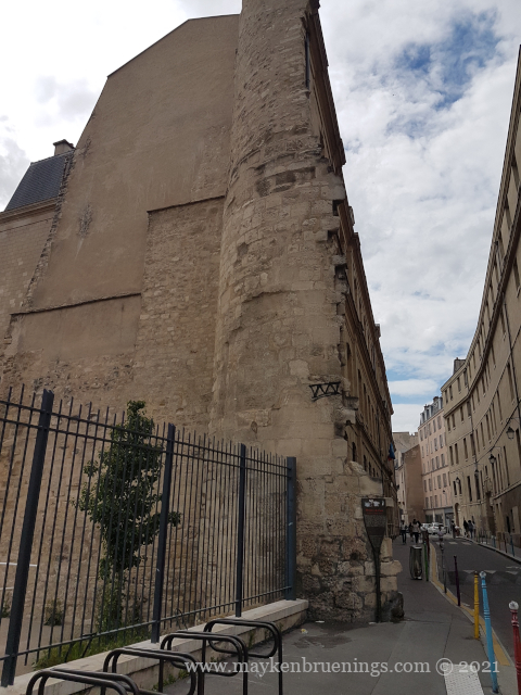
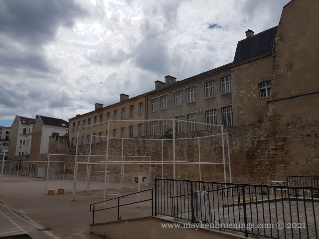
4th arrondissement (Saint Paul)
4th arrondissement (Saint Paul)
5th arrondissement (Panthéon)
He built the city wall that bears his name to defend Paris against attacks from the English Plantagenet dynasty in particular, coming from the north and the east. It was a simple wall 5km long with 77 towers.
4th arrondissement (Marais)
4th arrondissement (Marais)
Later he also built a second portion of the wall on the left bank, after Normandy fell into the hands of the Plantagenet, and an attack from the north-west had to be envisioned.
In order to protect Paris against invaders coming up the Seine river, Philippe Auguste had a fortress built, the Louvre Castle. (It was later demolished to make way for the Louvre Palace, but that’s a subject for another post.)
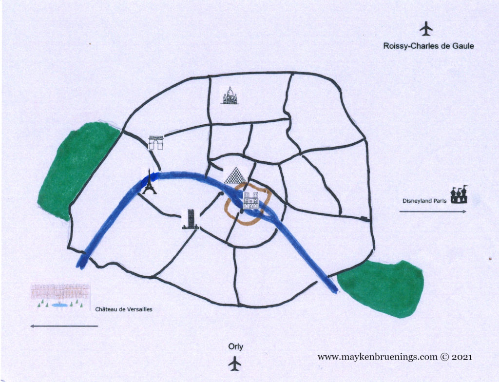
Since the first settlers built a fence around their settlement, the inhabitants of Paris have constructed walls around their habitat. As early as the 4th century CE, there were walls on Cité Island. As the city grew, new walls were erected, forming concentric circles, from Gallo-Roman times to the 21st century. Let’s have a closer look.
The city wall of Philippe Auguste dates back to the 13th century. Remains can be found near the Pantheon in the 5tharrondissement on the left bank, as well as in the 4tharrondissement on the right bank, in the Marais and near the Village Saint Paul.
The city wall of Charles V dates back to the 14th century. It was destroyed in the 17th century.
TheGeneral Farmers Wall was built between 1784 and 1791 by the corporation of tax farmers. It was no longer a wall to protect Paris from invaders but to collect taxes on incoming goods.
Finally, the Adolphe Thiers Wallfrom 1846 corresponds more or less exactly to the boulevard des Maréchaux of today.
The present-day Paris city limitlies just a little over 100m further out and is marked by the Boulevard Périphérique (“Périph” or BP) expressway, a 35km-long ring road around Paris, but also including the Bois de Boulogne to the west, the Bois de Vincennes to the east, and a heliport in the southwest, near the Seine river.
The evolution of Paris city walls
We will have a closer look at each of these walls in the following posts. Stay tuned!
The Latin Quarter takes its name from the shared language students from all over Europe spoke as they studied here in Medieval times. They still study at the Sorbonne and other Paris universities today, but Latin is no longer the lingua franca.
Sorbonne University in the Latin Quarter
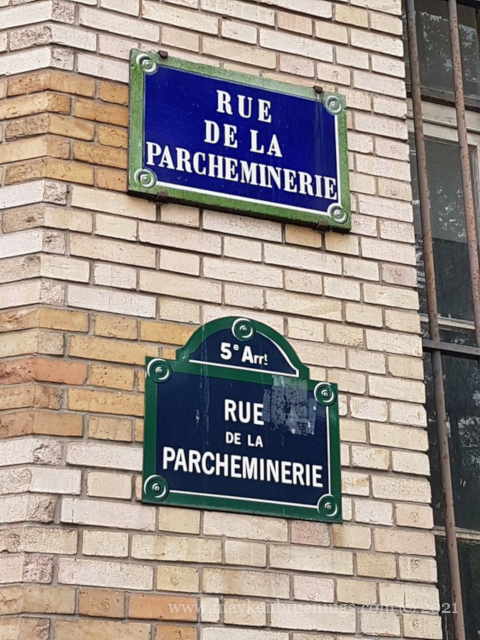
Back in the 13th century, when most people other than those students and their teachers couldn’t read or write, many public writers and manuscript-copying scribes lived in a street that took the name of “writers street”, rue des Écrivains.
In 1387, the street’s name changed to rue de la Parcheminenerie, for it was now home to parchment vendors. This coincided with a new kind of parchment, not as thick and coarse as the one used since the 7th century. It became widespread, and it was in this street that universities and students stocked up on it. In the 17th century, people still came here to stock up on books. Today the number 29 houses a Canadian bookstore.
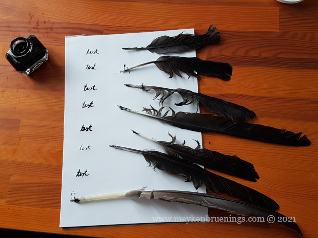
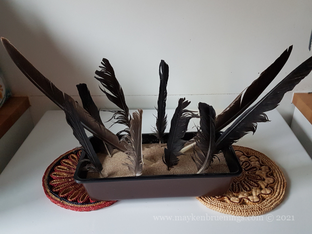
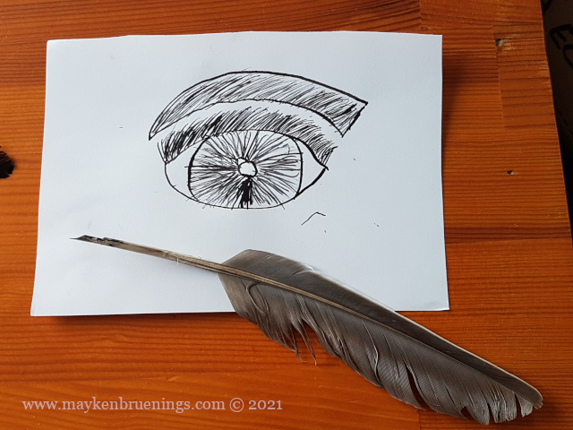
During research for my time travel story set in the French Renaissance in the early 16th century, my fingers started itching to use a feather quill as my time-traveling protagonist did. I found some how-to websites and got started.
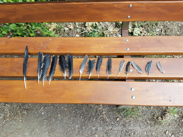
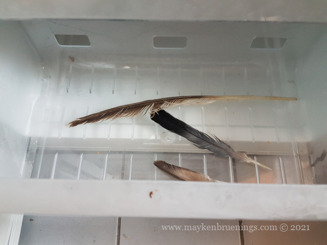
First, obviously, you need some nice feathers. I’ve been told the use of certain birds’ feathers may be forbidden in some countries, so please make sure you know where your feather comes from.
Find feathers in a park
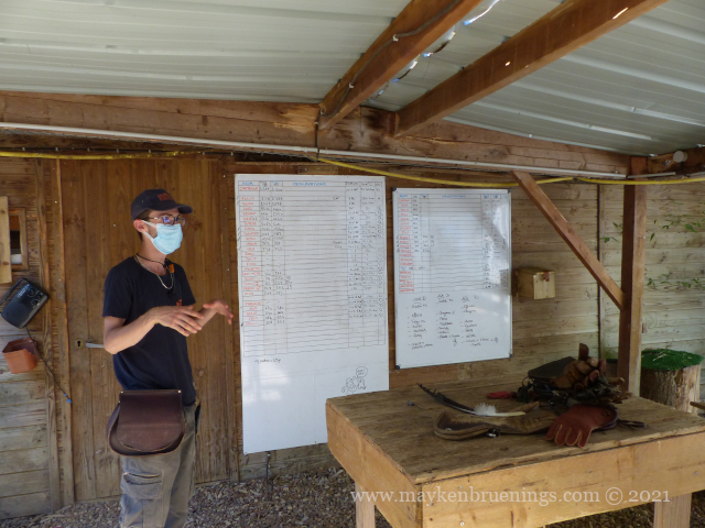
Know someone at the Zoo?
Other items you will need:
Soapy water and an old toothbrush or
Space in a freezer
A recipient big enough your feather fits completely in
Sand
An oven-proof recipient
A sharp knife, an x-acto knife or a cutter work best
A cutting board
Ink and paper
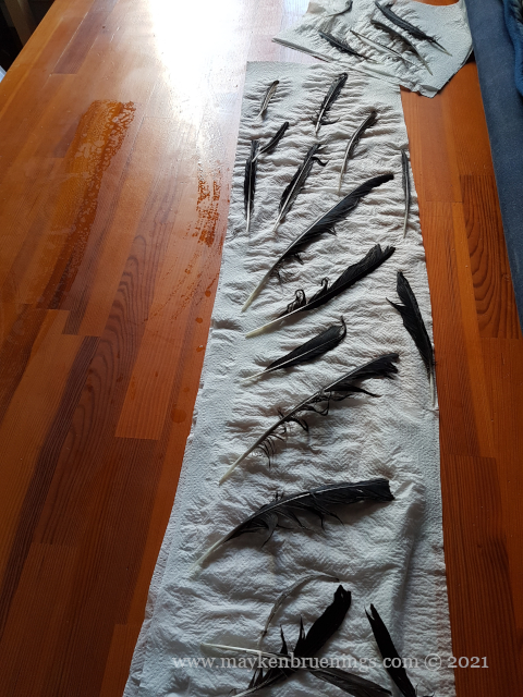
One internet source says to scrub them in soapy water (with an old toothbrush, for example). During a zoo visit, a bird keeper told me that leaving the feathers in the freezer for a day or two would kill off any vermin. (I left mine for two days, to be on the safe side.)
If you wash them, the next step is obviously letting them dry.
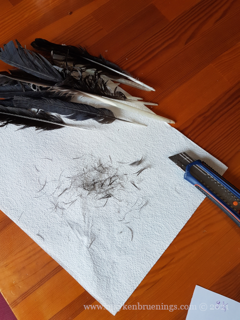
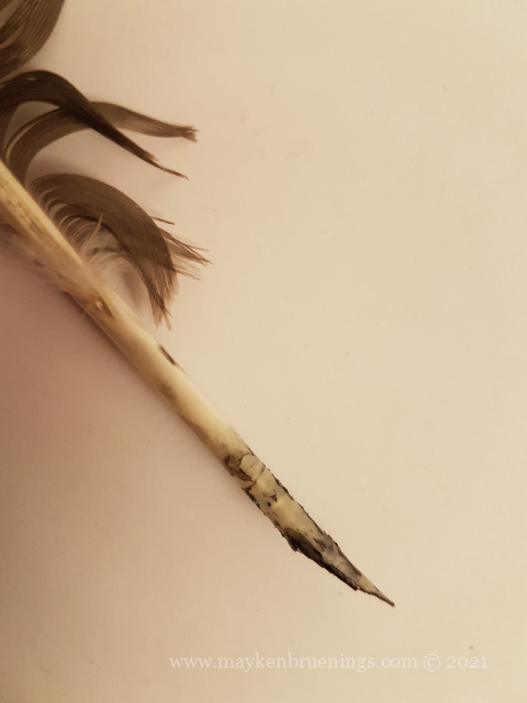
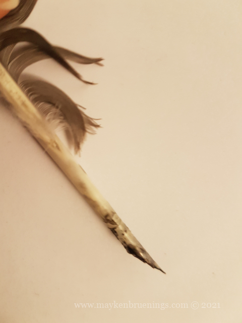
Then you shave off the fibers near the tip because once you dip your quill into the inkwell, you don’t want to have them dripping with ink.
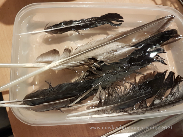
Next you leave them in water overnight. The instructions say this makes them soft and easy to bend.
Again, you let them dry.
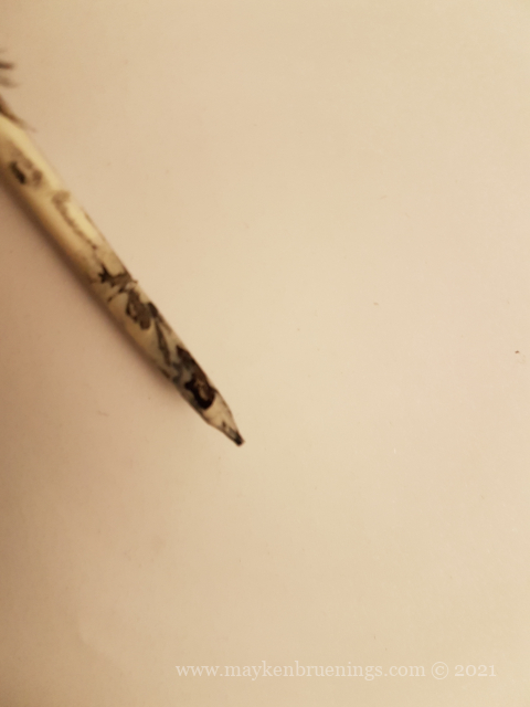
Heat sand in the oven to 350°F/175°C. Stick the feathers into the hot sand once you take it from the oven and leave them in there while the sand cools. This is supposed to harden the feather so you won’t have to resharpen it too often.
Now comes the trickiest part – cutting the tip into the right shape. Be warned, the feather is still surprisingly hard and cutting it in the shape you want will not be easy. Use a pen to trace the shape on the tip and then cut along your markings. This is more carving than cutting, actually. Once your nib has the right shape, you need to make a split at the center.
Now all you need is an inkwell, paper, and some practice. Look what my 10-year-old daughter did when I let her choose one of my feathers.
And to round it off nicely, here’s some history:
In Europe, the feather replaced the reed pen for writing in the 6th century CE. The birds whose feathers were most commonly used besides the goose were raven, duck and grouse for fine writing, and vulture and eagle feathers for bold writing. The feather dominates writing in Europe through the Middle Ages, Renaissance and Classical Period, until the invention of the metal-tip pen in the 19th century.
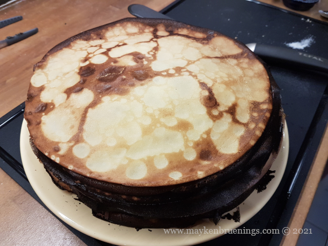
If you look at a French calendar on February 2nd, instead of Groundhog Day it will say Chandeleur. Your dictionary will translate that to Candlemas. But what’s that to do with crêpes?
The name Chandeleur comes from chandelle, the French term for candles (fancy ones, those you put on a birthday cake would be bougies). The fête des chandelles or Chandeleur has both pagan and Christian origins, like many Christian celebrations. In the Christian religion it corresponds to the presentation of Jesus at the Temple. The date is no accident, February 2nd marks 40 days after Christmas, and it concludes the Christmas-Epiphany season.
After the King Cake on Epiphany, the crêpes on Chandeleur symbolize the sun whose return was awaited impatiently by the farmers at the end of the winter.
A custom said to bring prosperity to the household consisted in turning the first crêpe with the right hand while holding a coin (even better, a gold coin!) in the left. French educational journalist Jamy Gourmaud makes a nice demonstration in his Chandeleur video (at 1’45).
Today, Chandeleur is an important occasion for the French to bake and eat crêpes. Even my local fromager had a crêpe stand a few days before Chandeleur this year!
What’s your favorite crêpe topping? Mine is the Nutella/banana/shredded coconut combo.
As first a settlement and later a city, Paris has existed for over 2,000 years. History has left its marks on the city, and traces of different time periods can be found all around Paris. In non-chronological order, let’s look at some that you might have come past during a visit without knowing.
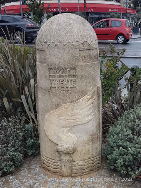
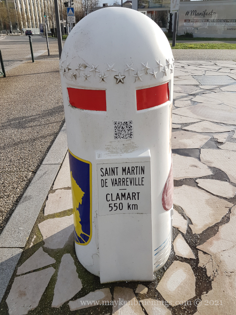
If you have been driving on the roads of northwestern France, maybe you have noticed stone markers with a flame in addition to regular distance markers. The bornes de la liberté are set along the route of the Allied Forces from D-Day in June 1944. Liberty Road (la Voie de la Liberté) starts in Normandy, travels across northern France to Metz near the German border and then northwards to Bastogne on the border of Luxemburg and Belgium. But other markers can be found outside of this main route.
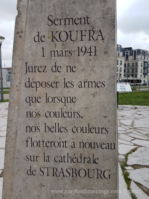
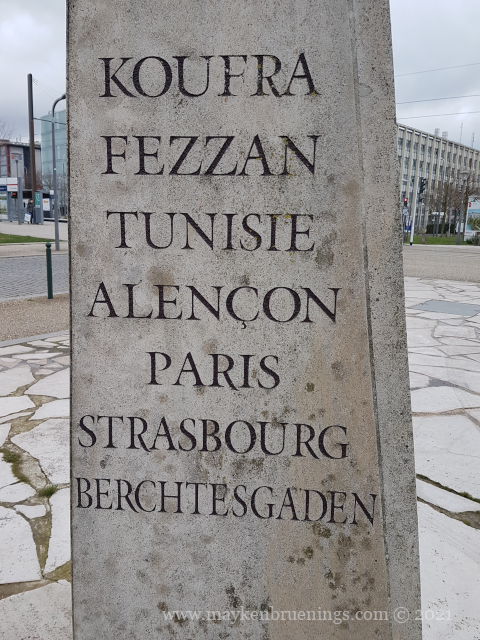
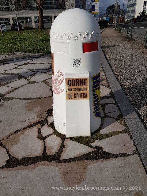
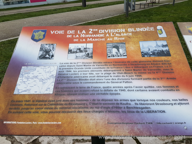
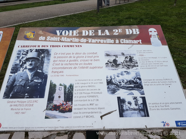
In March 1941, following the battle of Kufra in Libya, Leclerc (then a colonel) and his men swear an oath to “not put down the arm until our colours fly over the cathedral of Strasburg”. They fulfilled their oath in November of the same year. But before they could liberate Strasburg, they had to liberate Paris.
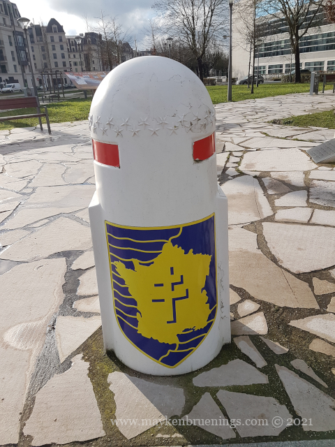
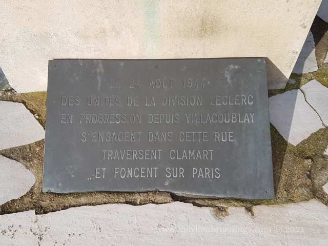
In August 1944, the Second Armored Division, in French 2e Division Blindée shortened to 2e DB, marched into Paris from the south. Commanded by the now General Leclerc, it was also called the Division Leclerc.
This monument commemorates not only the Oath of Kufra and the Liberation itself but also the events in this town the 2e DB crossed.
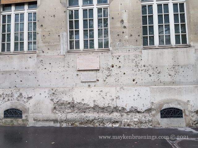
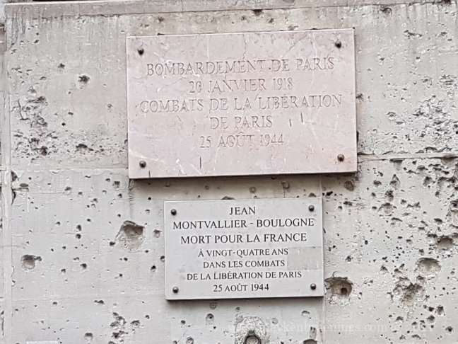
Traces of the combat in Paris in August 1944 can be found–among other places–on the wall of the Paris School of Mines on the boulevard Saint Michel (6tharrondissement, near the Luxemburg Gardens).
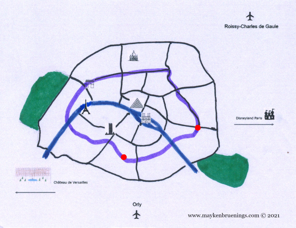
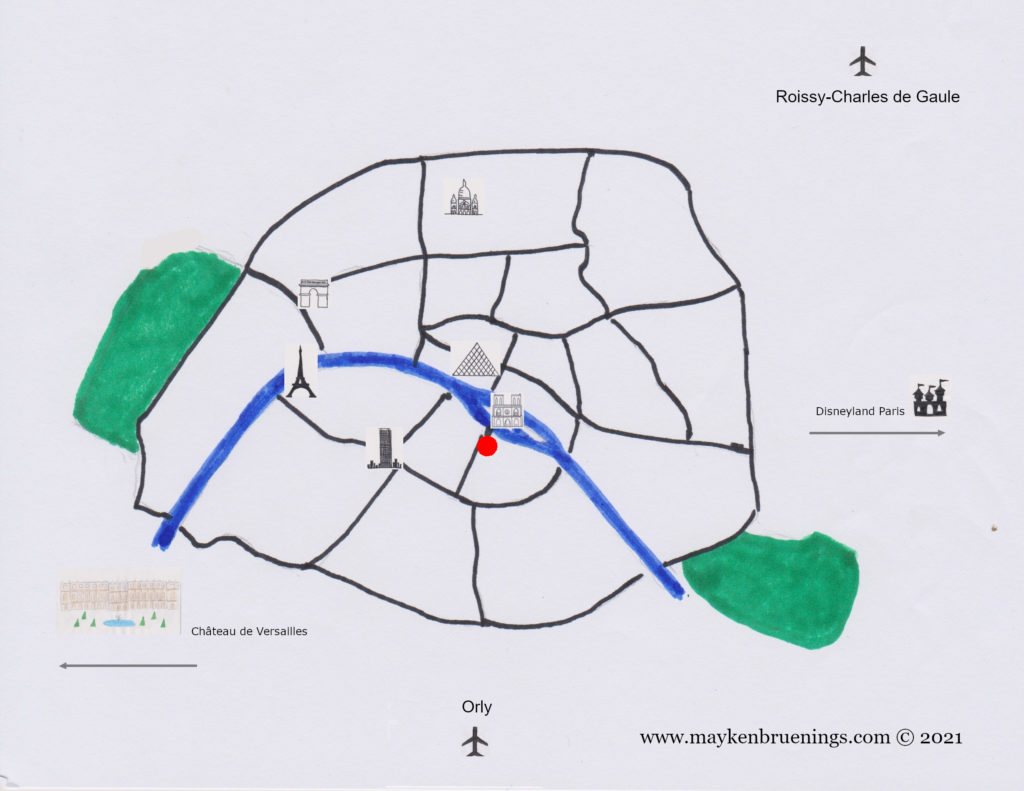
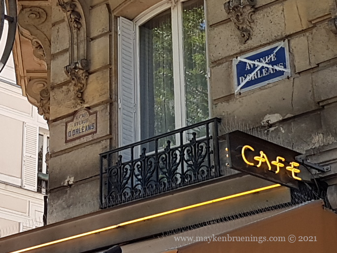
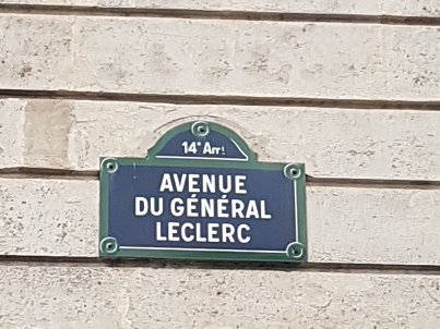
The avenue d’Orléans, in the 14tharrondissement leading from the Porte d’Orléans to the Place Denfert-Rochereau is today called Avenue du Général Leclerc.
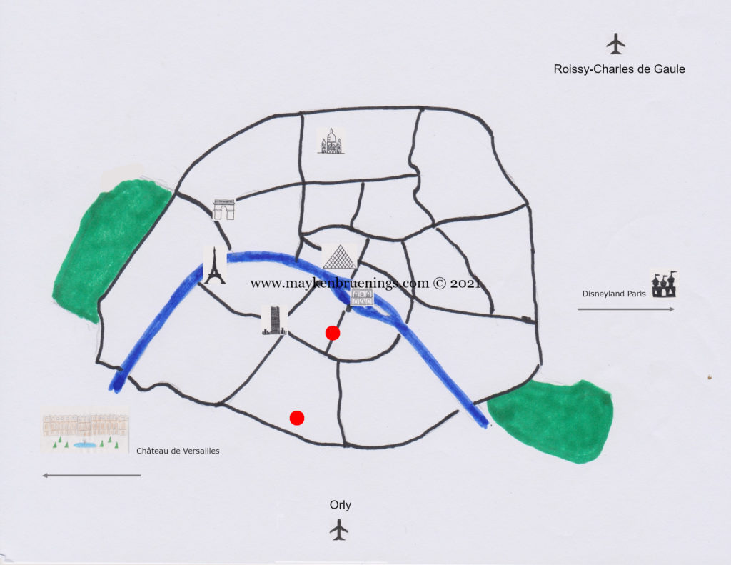
Map of Paris showing the Avenue du Général Leclerc (the lower point) and the wall of the Paris School of Mines (the upper point).