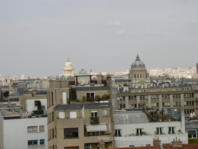
There are a number of cupolas in the Paris skyline. In this new series, Cupolas of Paris, we will have a look at the most prominent ones and what is hidden below them:
The Dôme des Invalides – 7tharrondissement – built under Sun King Louis XIV in the 17th century
The Panthéon – 5tharrondissement – built in the 18th century
The Sorbonne – 5tharrondissement – built in the 17th century
The Observatory – 14tharrondissement – built under Sun King Louis XIV in the 17th century
The Val de Grâce – 5tharrondissement – built under Sun King Louis XIV in the 17th century
The Institut de France – 6tharrondissement – built under Sun King Louis XIV in the 17th century
1 Invalides – 2 Panthéon – 3 Sorbonne – 4 Observatory – 5 Val de Grâce – 6 Institut de France
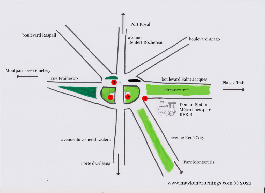
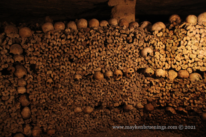
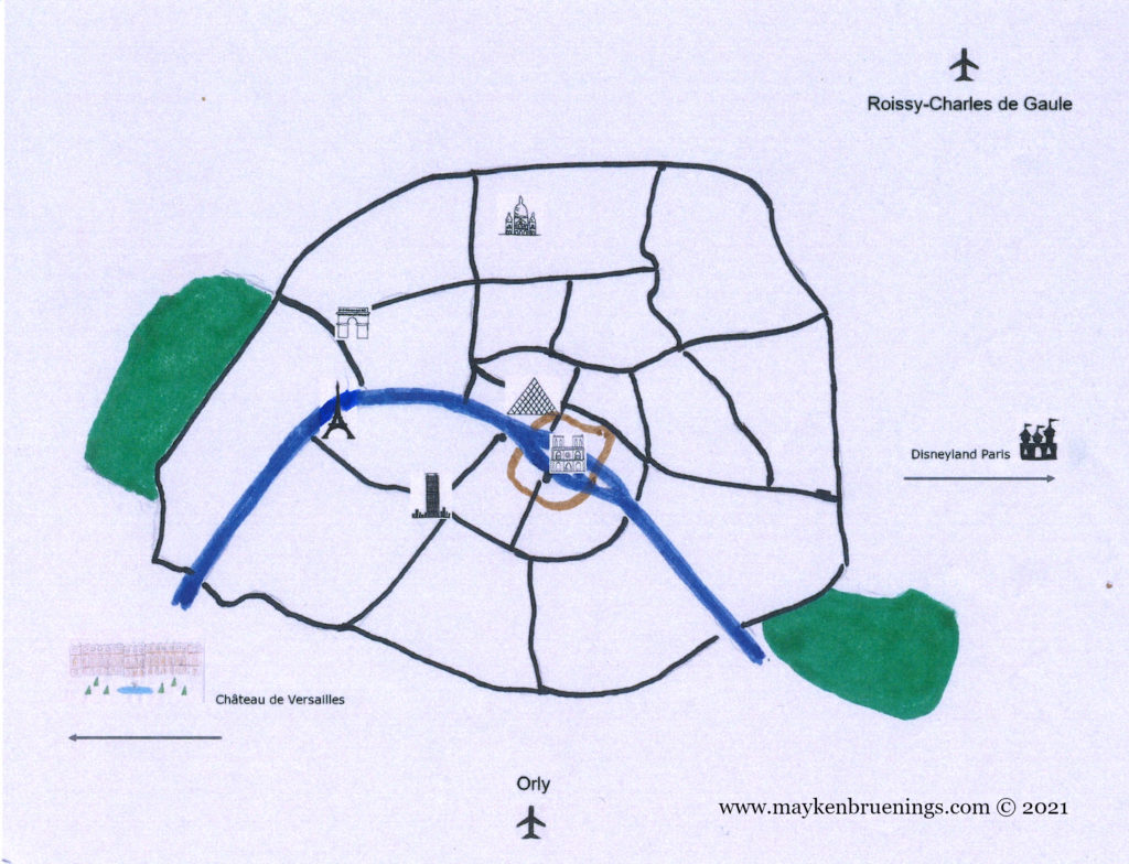
The Denfert-Rochereau intersection in the 14tharrondissement is known by tourists mainly for the entrance to the catacombs and for the departure of the airport buses to Orly airport. There is, however, a whole lot more. Let’s have a look at the intersection.
No fewer than seven streets intersect here. First, the north-south axis:
Avenue Denfert Rochereau to the north, it leads to Port Royal.
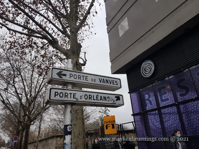
Avenue du Général Leclerc to the south, it leads to Porte d’Orléans (see also La Libération).
To the west, rue Froidevaux, which runs alongside Montparnasse cemetery in the direction of Montparnasse.
To the east, boulevard Saint Jacques which turns into boulevard Auguste Blanqui and runs towards Place d’Italie, with a partially overground stretch of metro line 6.
To the northeast, boulevard Arago, and to the southeast, along the train line, avenue René Coty, leading to the Parc Montsouris.
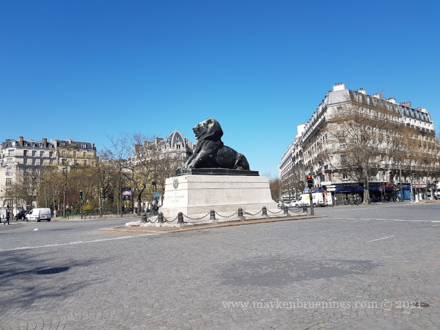
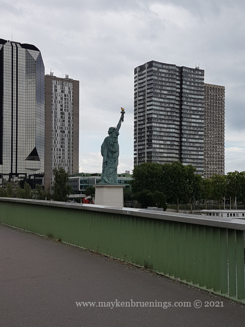
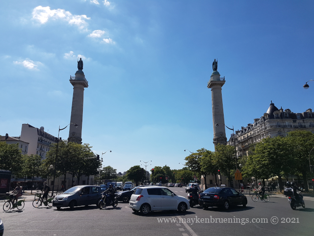
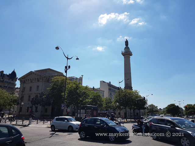
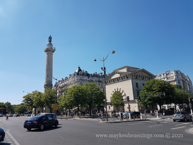
Now for the intersection itself. At its center thrones the Belfort Lion of Paris (3). It is a one-third size copper replica of the Belfort Lion, both of which were created by Auguste Bartholdi. It looks in the direction of the Statue of Liberty, also created by Bartholdi. The Belfort Lion in the city of Belfort, in eastern France, is a red sandstone monumental sculpture commemorating the heroic French resistance during the siege of Belfort during the Franco-Prussian war.
A view of the northern side of the intersection
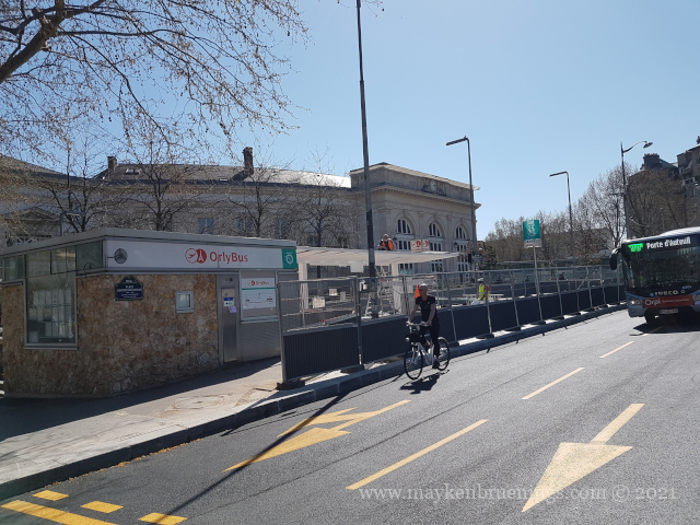
On the east side of the intersection, between Saint Jacques and René Coty, is the Denfert Rochereau station, served by metro lines 4 and 6 and the RER B which leads to both Paris airports, Roissy-Charles de Gaulle in the north and Orly in the south. Outside the station, there’s the Orly airport bus station (4).
Denfert station, currently undergoing works
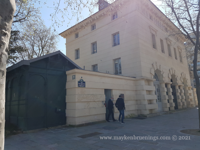
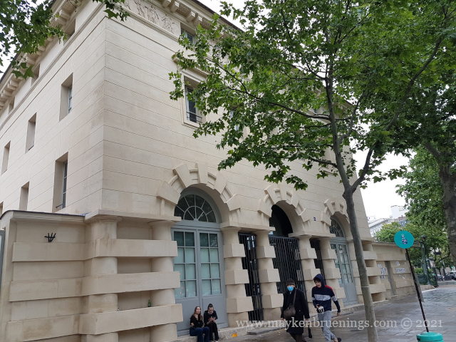
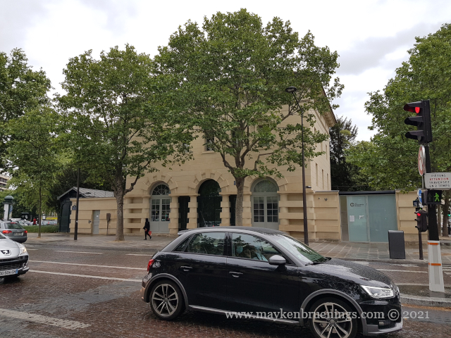
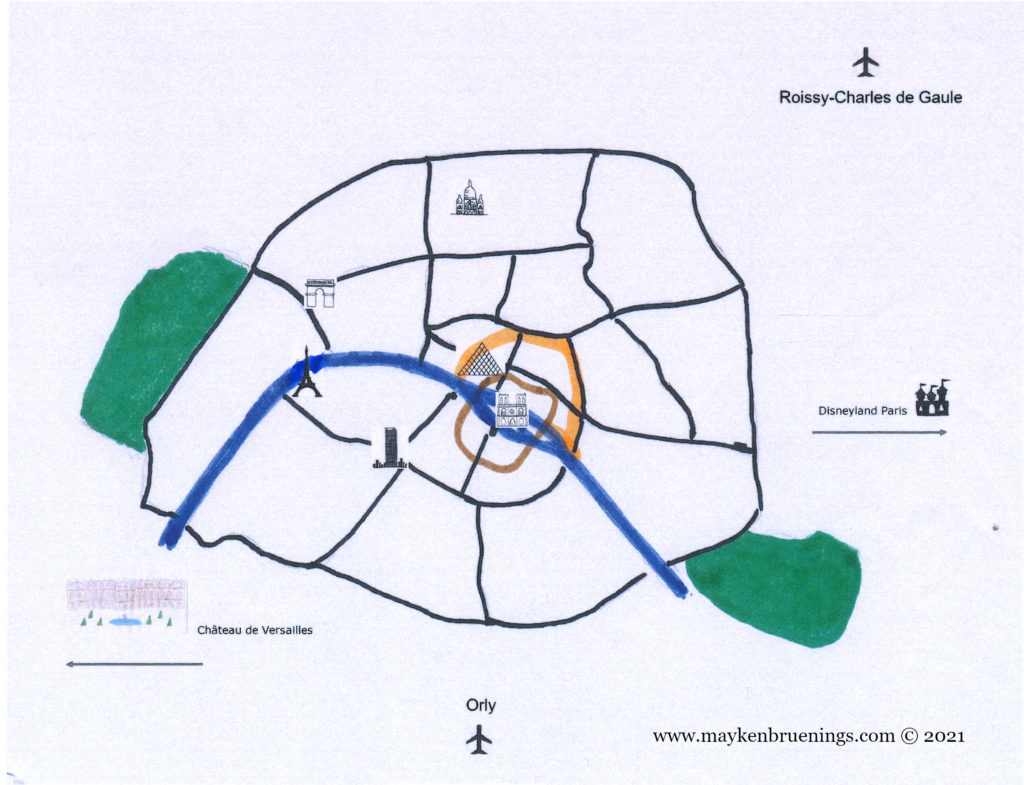
At the center of the intersection, south of the lion, the lodges of the barrière d’Enfer, an entry point of the General Farmers tax wall house two museums: the Paris catacombs on the east side (2) and the Museum of the liberation of Paris on the west side (1).
Denfert tax lodge with entrance to the Catacombs
Avenue du Colonel Henri Rol-Tanguy, tax lodges and Denfert station
The lower part of the Place Denfert was renamed in 2004 to Avenue du Colonel Henri Rol-Tanguy to honor this communist resistant (1908-2002) who led the insurrection of the capital in August 1944 from his command post in the catacombs underneath the intersection.
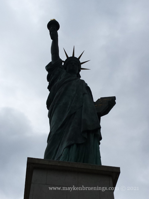
The Statue of Liberty was created by the French sculptor Frédéric Auguste Bartholdi, with the metal framework built by Gustave Eiffel. It was a gift of the French people to the United States of America and was inaugurated on October 28, 1886.
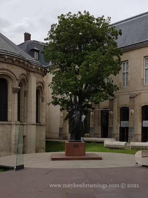
Bartholdi first created a reduced-size model in plaster which you can now find a the Musée des Arts et Métiers in Paris. In the courtyard of the museum, there is a bronze made from this plaster made by the museum.
Bronze at the Musée des Arts et Métiers
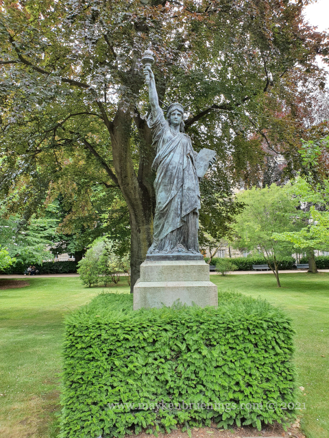
The first bronze model made from the plaster was given by Bartholdi to the Musée du Luxembourg in 1900. The statue was set up in the Luxemburg Gardensbut in 2012, it was transferred to the Musée d’Orsay and replaced in the park by a copy.
The Statue of Liberty replica in the Luxemburg Gardens
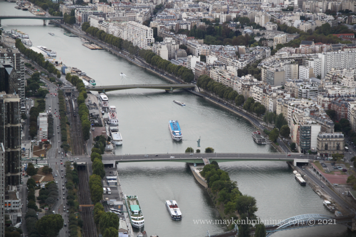
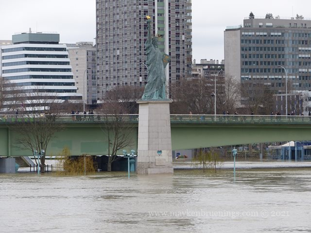
In 1885, another bronze copy was made and given to France by the Committee of Americans in Paris at the centennial of the Revolution. It was set onto the Île aux Cygnes (an artificial island in the Seine that was created to support, among others, the Pont de Grenelle bridge) at the height of the Pont de Grenelle, near the place where Bartholdi’s workshop was.
The Statue of Liberty on the tip of Cygnes Island as seen from the Eiffel Tower
It was inaugurated by President Carnot on July 4, 1889, three years after the original statue in New York, and in the presence of its creator. The statue looked eastwards so that the president didn’t have to inaugurate it from a boat and to inaugurate a statue that turns its back on the Elysée (the presidential palace) despite Bartholdi having asked that it look towards New York. The statue was finally turned to look towards its big sister for the 1937 World Fair.
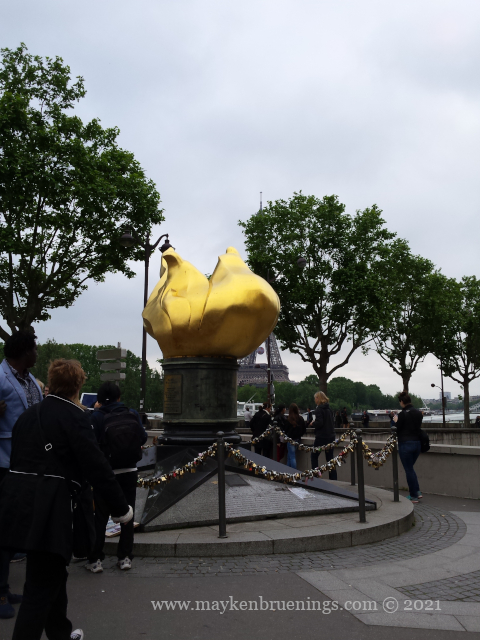
Since 1989, there is also a replica of the flame in its original size. It is located on the Place de l’Alma, a gift from the United States to the City of Paris. It is best known nowadays as the remembrance site from Princess Diana who died in 1997 ins car crash in the Tunnel de l’Alma just below the monument.
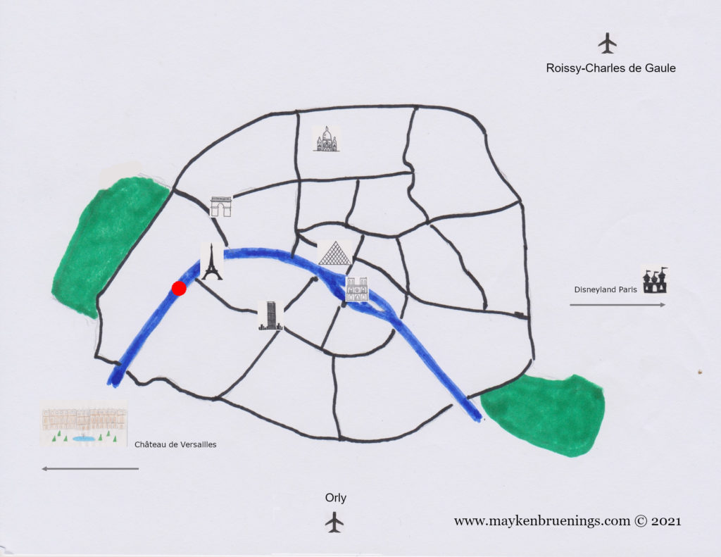
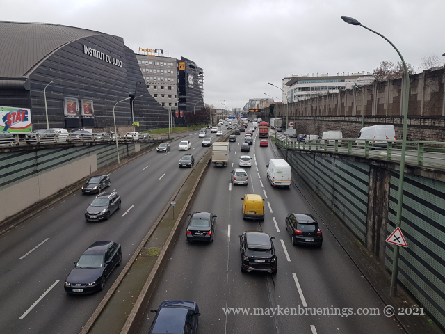
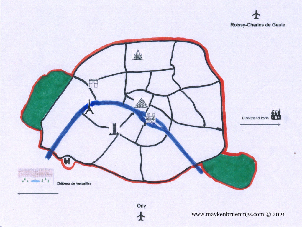
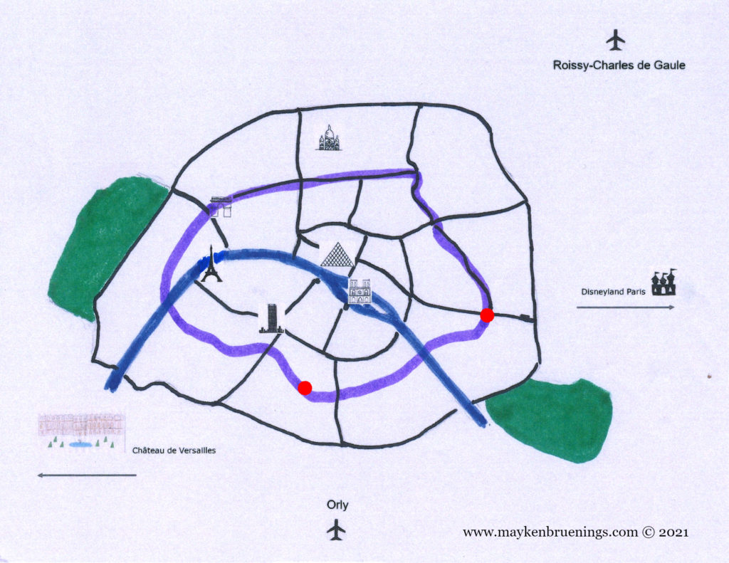
Today, the limits of the city of Paris which is at the same time the département of Paris (n° 75) coincide with the expressway Boulevard Périphérique (“le Périph’” or “BP”), a 35km-long dual carriageway with the particular rule that entrants have priority over those already on the expressway. The speed limit is 70km/h but most of the time traffic jams don’t allow for that speed anyway. The Périphérique intérieur runs clockwise, the Périphérique extérieur counter-clockwise.
The “Périph” at Porte d’Orléans
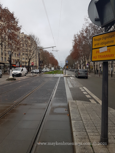
The strip between the boulevards des Maréchaux (“les Maréchaux”) and the Périph’ is occupied by social housing, schools, and sports equipment.
Tramway on the Boulevards des Maréchaux
There are three “extensions” to the surface of the city of Paris that lie outside of this limit: the Bois de Boulogne park to the west, the Bois de Vincennes park to the east, and the Paris heliport in the southwest near the Seine river, belonging to the 15tharrondissement.
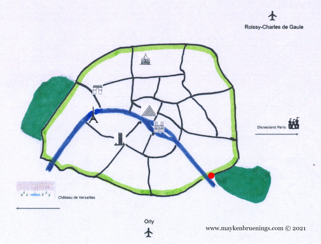
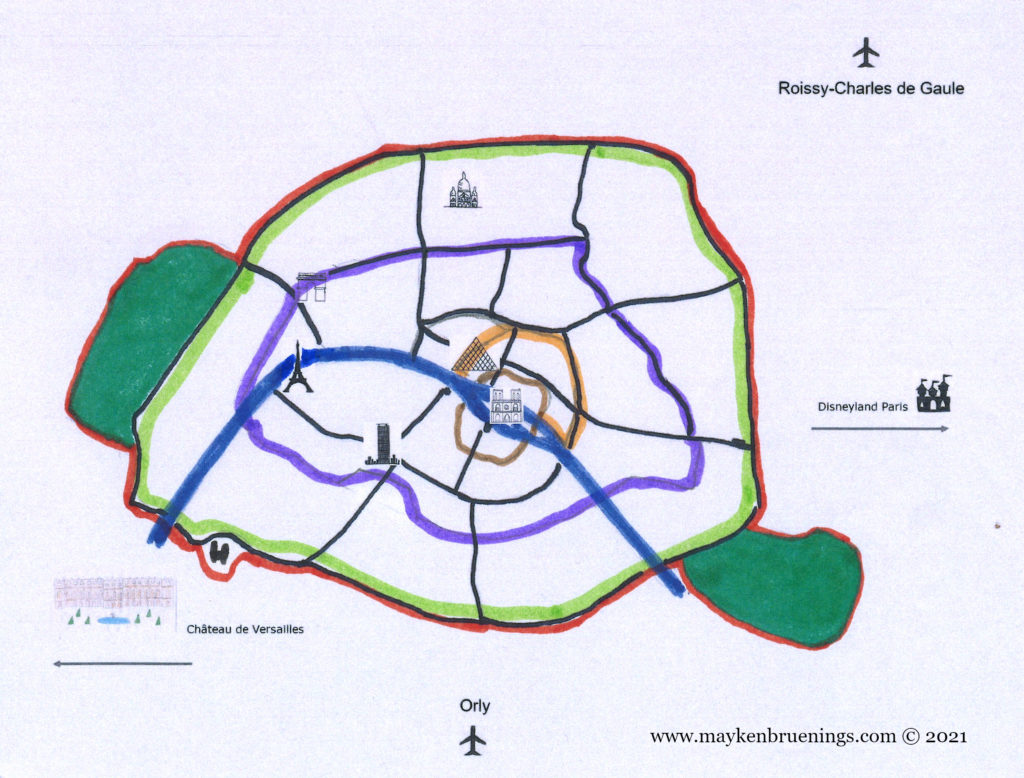
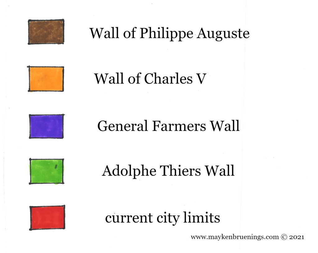
The final city wall that was an actual wall was built between 1841 and 1844 on the orders of Adolphe Thiers, President of the Council, a position that corresponded to that of Prime Minister. It ran around the entire city, a space of almost 80km² and followed the boulevards des Maréchaux, a 33,7km-long ring road named after Marshals of the First French Empire that circles Paris and can today be traced by the PC (Petite Ceinture) buses (west) and the tram lines T3A (south and east) and T3B (east and north).
It was destroyed between 1919 and 1929, and only very few short sections remain, such as Bastion 44 in the rue du Bastion in the 17tharrondissement, the Poterne des Peupliers (a postern) in the 13tharrondissement or Bastion 1 at Porte de Bercy in the 12tharrondissement, in the middle of the Bercy interchange.
The Adolphe Thiers wall (in light green) and the location of Bastion n° 1
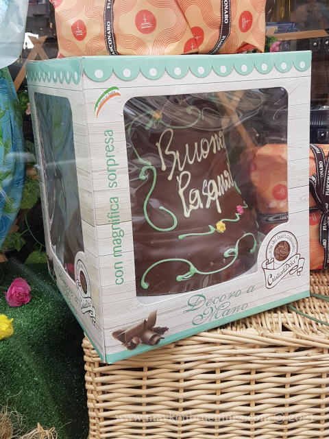
Who brings the Easter eggs where you live? I’ve grown up with the trusty Easter bunny, but when I came to France, I found to my surprise that the bunny is only a recent “import” and that traditionally, the Easter eggs are brought by someone else. Seeing chocolate chicken in stores along with eggs and bunnies, you might be tempted to guess the French have kept it realistic and told their kids the Easter hen brings the eggs. But that’s not what it is at all!
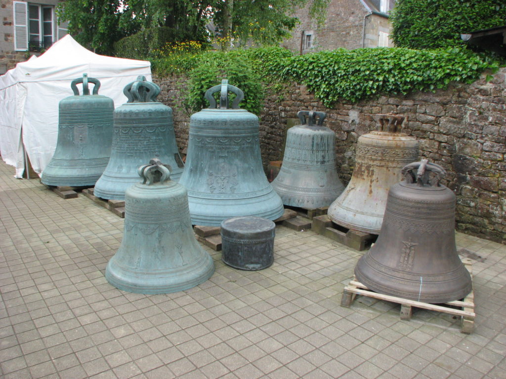
In France, the Easter eggs are brought by the church bells on their return from Rome.
traveling church bells
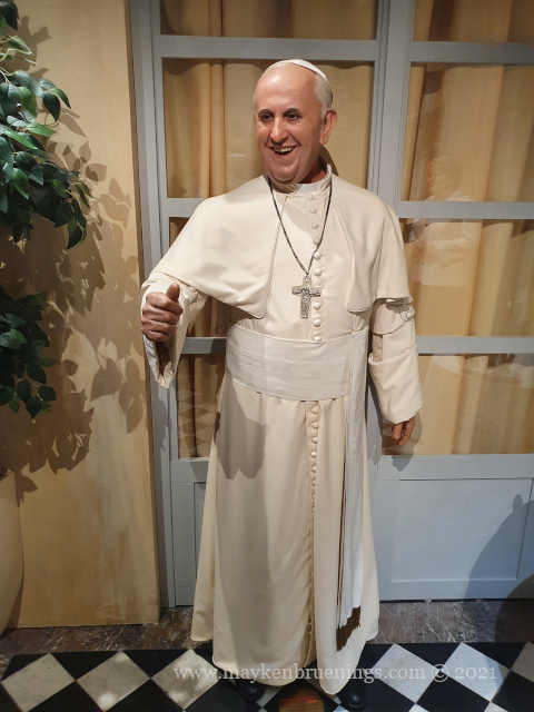
You see, after Holy Thursday, French church bells go silent until Easter Sunday, to mark the mourning for Jesus Christ, a Catholic tradition that goes back several centuries. Children are told the bells go to Rome, to get blessed by the Pope, and upon their return, they bring the eggs and hide them for the children to find.
The Pope, ready to bless church bells?
Hence the chocolate bells you will find in French (and also Italian) stores alongside eggs, hens, and Easter bunnies.
The Ferme Générale was an outsourced customs, excise and tax collection operation created under King Louis XIV in 1681. It taxed goods coming into the city in the name of the king. Between 1784 and 1791, it built a 5m-high and 25 long wall around the city that was not meant to protect against invaders but to prevent any merchandise to enter the city without paying taxes. However, smugglers used the old quarries running under the wall in what is today the 14tharrondissement.
The Barrière d’Enfer lodges at Place Denfert-Rochereau
Two entry points of this tax wall can still be seen today: the lodges of the barrière d’Enfer at Denfert-Rochereau in the south (14tharrondissement), and the barrière du Trône at Place de la Nation (11th/12tharrondissements) to the east.
The Barrière du Trôme at Place de la Nation
The Barrière du Trôme lodges at Nation
The General Farmers Wall (in purple) and the location of the d’Enfer and Trône lodges
In the 14th century, King Charles V had a new wall built on the right bank but the Philippe Auguste wall was not demolished for all that, since it was considered so solid and wide that a cart could run on top of it.
Charles V was king of France from 1364 to 1380. His reign marks the end of the first part of the Hundred Years War, as he recovered almost all of the lands lost by his predecessors. He was a learned king who founded the first royal library, predecessor to the French National Library (Bibliothèque Nationale de France).
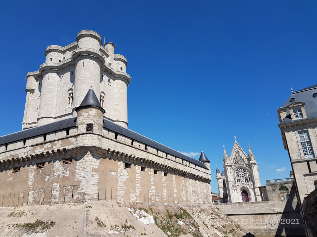
In 1356, Étienne Marcel, Prévôt des Marchands (a position similar to that of a mayor) had a new wall constructed on the right bank, however, he died before the works were completed. Charles V continued the fortification works following his tactics of terre déserte (“better a crushed land than a lost land”) and reinforced the Philippe Auguste wall on the left bank while creating a whole new wall on the right bank that was 5km long and consisted of a combination of ditches and earth-filled ramparts, the last of which was crowned by a small wall. The fortification extended beyond the Louvre Castle to the west, which made the castle lose its protective function. In the east, however, the residence of the king, the Hôtel Saint Pol, was poorly protected and therefore another small bastion was built: the Bastille. It protected against invasions through the Porte Sainte Antoine gate, and in case of an insurrection within Paris, it covered the road leading to the Château de Vincennes, the king’s residence outside of Paris.
The Château de Vincennes
The Charles V wall was destroyed in the 17th century, and there are few remains today. However, it left its imprint on the map of the city, as many boulevards run along the site of the fortification, such as boulevard Saint Denis, boulevard Saint Martin, boulevard du Temple, boulevard des Filles-du-Calvaire, boulevard Beaumarchais and boulevard Bourdon, to name only a few.
The purple line shows the boulevards named above – running along the Charles V wall (see map below).
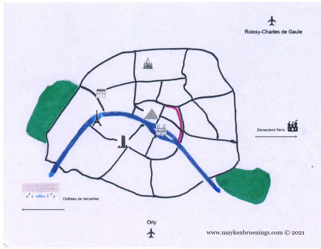
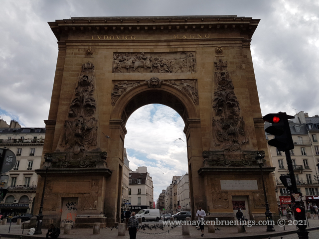
In 1672, Louis XIV, the Sun King, had a triumphal arch built on the site of one of the former wall’s gates, the Porte Saint Denis. Two years later, he had another triumphal arch built about 250m away, the Porte Saint Martin. The names are misleading since neither of them was ever meant to be a gate, but to glorify Louis XIV and his military victories.
Porte Saint Denis
Porte Saint Martin
Charles V wall (orange) and Philippe Auguste wall (brown)
In Gallo-Roman times, the population of Lutetia lived mostly on Cité Island and the south shore. There are still some remains to be seen today that will be the subject of a later blog post.
Philippe Auguste was king from 1180 to 1223 CE. He stands out among medieval kings of France for his long reign, his important military victories and his measures to reinforce the power of the king and put an end to feudalism.
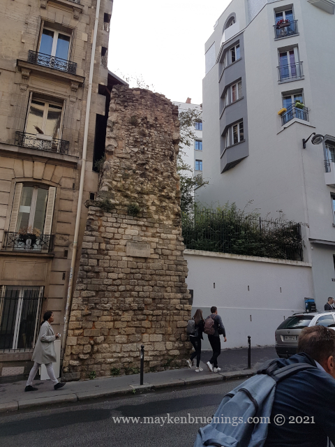
4th arrondissement (Saint Paul)
4th arrondissement (Saint Paul)
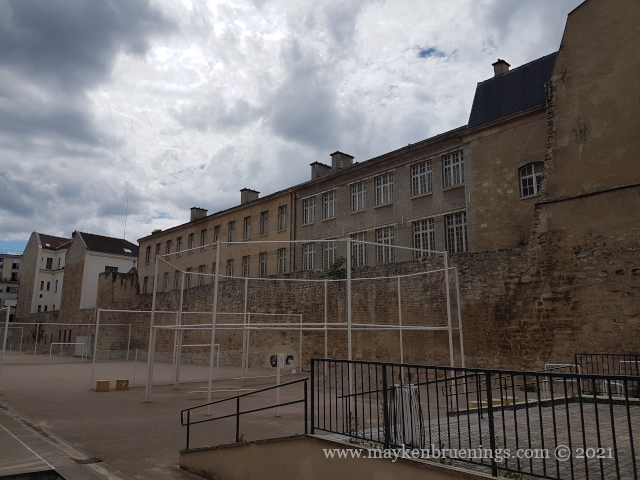
5th arrondissement (Panthéon)
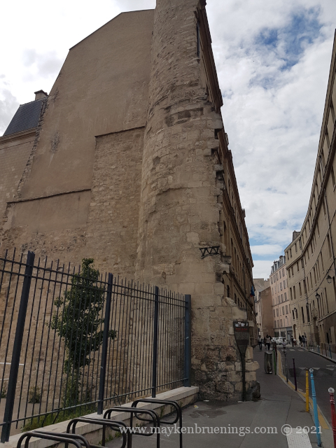
He built the city wall that bears his name to defend Paris against attacks from the English Plantagenet dynasty in particular, coming from the north and the east. It was a simple wall 5km long with 77 towers.
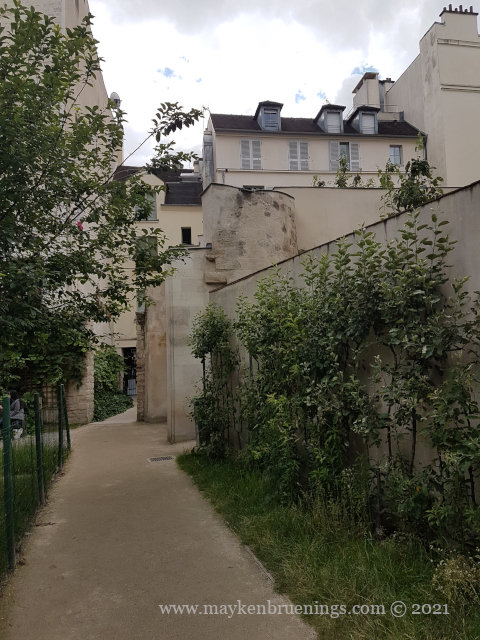
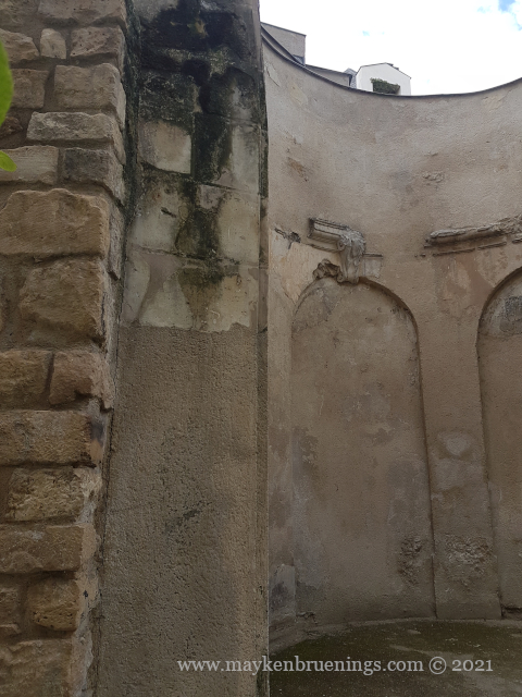
4th arrondissement (Marais)
4th arrondissement (Marais)
Later he also built a second portion of the wall on the left bank, after Normandy fell into the hands of the Plantagenet, and an attack from the north-west had to be envisioned.
In order to protect Paris against invaders coming up the Seine river, Philippe Auguste had a fortress built, the Louvre Castle. (It was later demolished to make way for the Louvre Palace, but that’s a subject for another post.)
Since the first settlers built a fence around their settlement, the inhabitants of Paris have constructed walls around their habitat. As early as the 4th century CE, there were walls on Cité Island. As the city grew, new walls were erected, forming concentric circles, from Gallo-Roman times to the 21st century. Let’s have a closer look.
The city wall of Philippe Auguste dates back to the 13th century. Remains can be found near the Pantheon in the 5tharrondissement on the left bank, as well as in the 4tharrondissement on the right bank, in the Marais and near the Village Saint Paul.
The city wall of Charles V dates back to the 14th century. It was destroyed in the 17th century.
TheGeneral Farmers Wall was built between 1784 and 1791 by the corporation of tax farmers. It was no longer a wall to protect Paris from invaders but to collect taxes on incoming goods.
Finally, the Adolphe Thiers Wallfrom 1846 corresponds more or less exactly to the boulevard des Maréchaux of today.
The present-day Paris city limitlies just a little over 100m further out and is marked by the Boulevard Périphérique (“Périph” or BP) expressway, a 35km-long ring road around Paris, but also including the Bois de Boulogne to the west, the Bois de Vincennes to the east, and a heliport in the southwest, near the Seine river.
The evolution of Paris city walls
We will have a closer look at each of these walls in the following posts. Stay tuned!