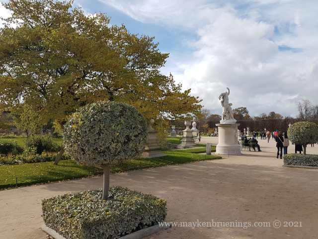
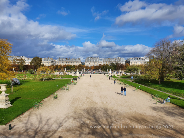
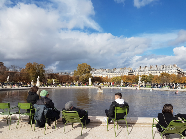
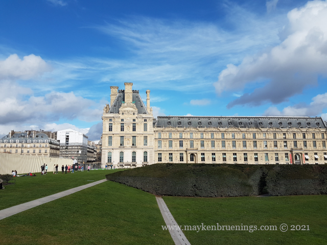
The Jardin des Tuileries is a 55 acres parc located between the Louvre and the Place de la Concorde. Its name derives from the tuileries (brickyards) that were in its place in the 13th century. Catherine de’ Medici, widow of king Henry II and mother of king François II, bought the lands which lay west of the Louvre and outside the Charles V city wall to have a new palace built with more space for gardens. Construction of the Palais des Tuileries began in 1564, and the Italian Gardens were set up on the lands between the new palace and what is today the Place de la Concorde.
The Palais des Tuileries burnt down during the events of the Commune and its remains were demolished in 1883.
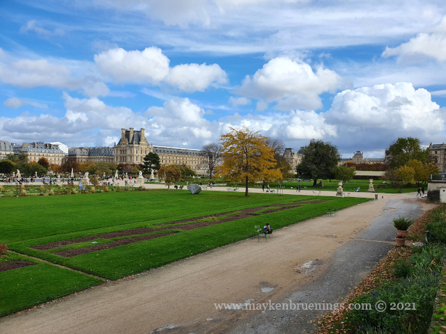
This is where the Tulieries Palace stood
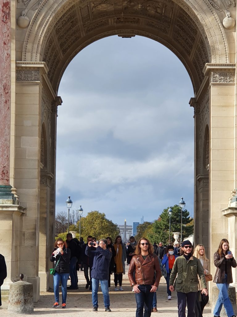
The historic axis has a slight kink at the Tuileries Palace site as you will notice if you stand at the Arc de Triomphe du Carrousel. The straight line that runs from Concorde along the Champs Élysées to the Arc de Triomphe de l’Étoile and beyond it to the Grande Arche de La Défense, was originally centered on the façade of the Tuileries Palace. The line east of the Tuileries Palace was centered on the façade of the Louvre, and since the two façades are at slightly different angles, the line in its continuation is not straight.
Look closely at these two images, and you will see the line is not straight!
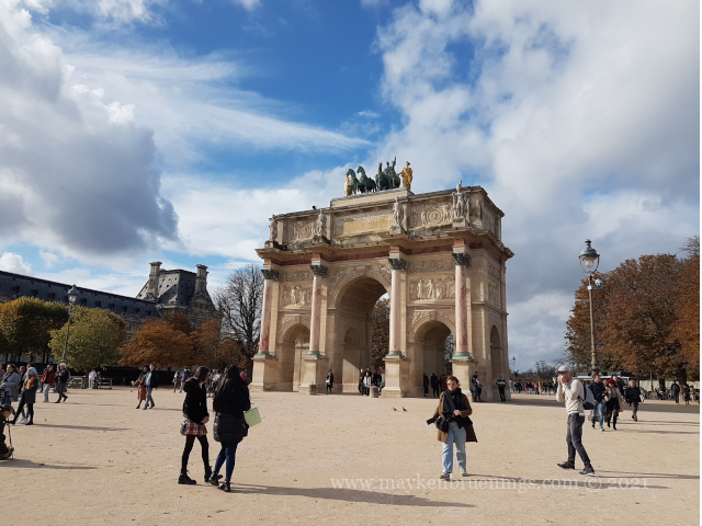
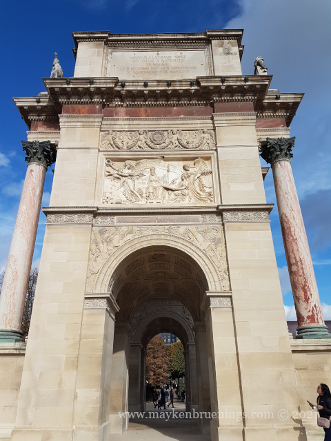
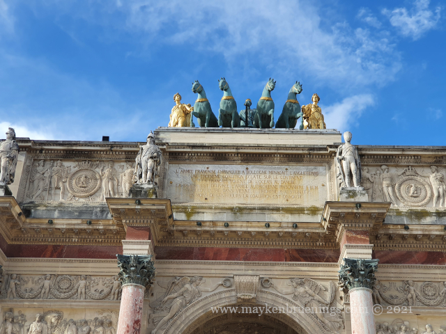
An Arc de Triomphe is a Triumphal Arch, a concept dating back to Roman times. This particular arch was built by Napoléon Ier in the style of the Arch of Septimius Severus on the Forum Romanum. In the same way at that Roman arch, it commemorates an army and, obviously, a triumph, namely that of the Grande Armée in the years prior to its construction which began in 1806.
But what is a carrousel? In this case, the term refers to a type of military dressage. The Place du Carrousel where the arch is located takes its name from the Grand Carrousel, which took place there on June 5-6, 1662, on the orders of Louis XIV to celebrate the birth of his firstborn son Louis (who despite being the Dauphin, did not become king after his father).
The arch was not yet part of a special axis, even though planning and construction of the Arc de Triomphe de l’Étoile began the same year. In fact, it was built right in front of the Tuileries Palace that closed off the Louvre on its western end and became its gate of honor.
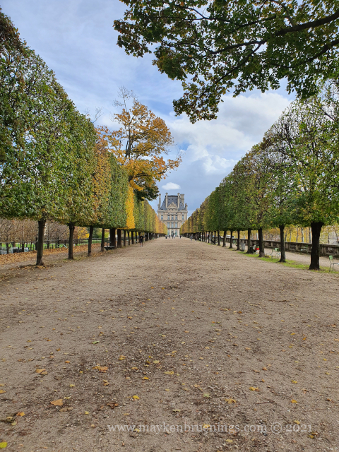
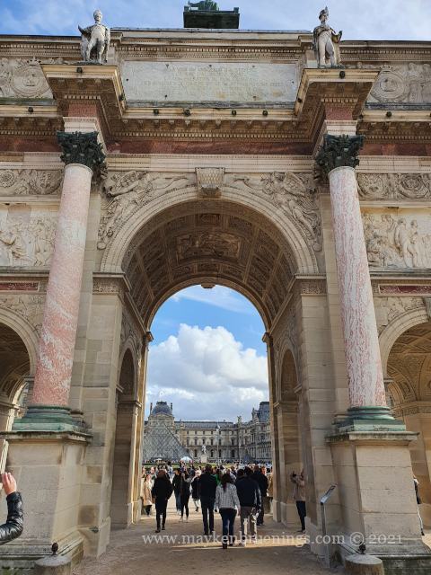
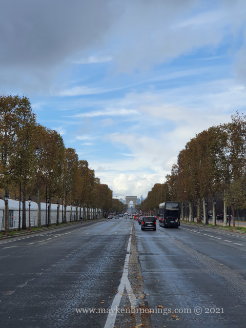
Instead of the destroyed Tuileries Palace, you see elements of the axe historique
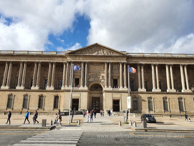
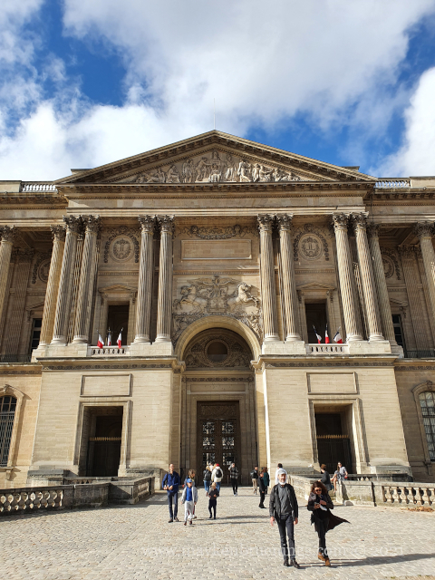
The main entrance When the Louvre was a royal palace, its main entrance was on the east side, the majestic gate facing the church Saint Germain l’Auxerrois. The triangular bas-relief on the pediment consists of two stone slaps each 17.5 meters long and weighing several tons.
Louvre – east gate
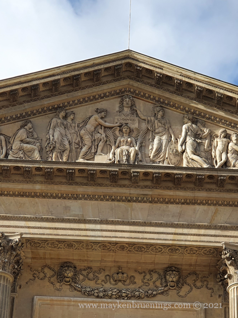
Napoléon transformed into Louis XIV Napoléon Ier was represented at the center, with one of the Muses writing “Napoleon completed the Louvre”. This didn’t please King Louis XVIII, and the inscription was changed to “Ludovico Magno”, in reference to the Sun King Louis XIV. The crown was removed from Napoléon’s head and replaced with the curly wig of the Sun King. However, Napoléon’s face remained, along with a shield featuring his imperial eagle and his bees.
Napoléon transformed into Louis XIV
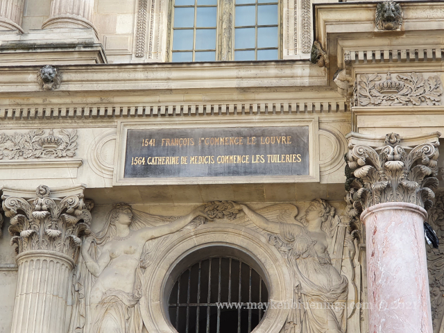
From castle to palace King François Ier (1494-1547) began the transformation of the Château du Louvre to the Palais du Louvre by knocking down the keep. His son and successor Henri II continued his project.
“1541 – François I starts the Louvre”
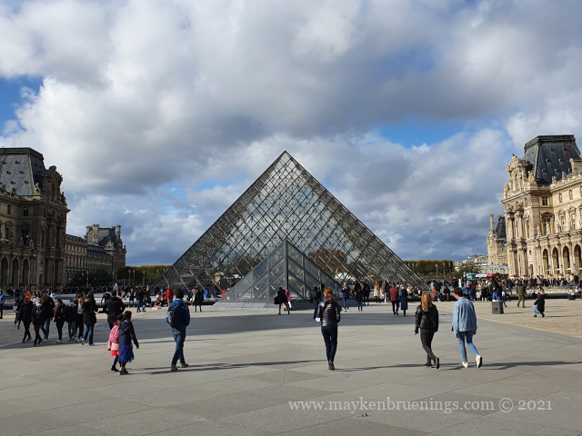
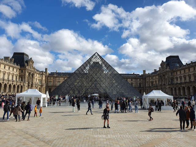
The Pyramids The Louvre Pyramid was a subject of controversy when its project was presented. It was at the center of a project improving access to the museum, which couldn’t handle the growing visitor influx. As confirmed by the Louvre, it consists of 673 panes, not 666 as myths will have it. (Count them if you want.)
The Louvre pyramid
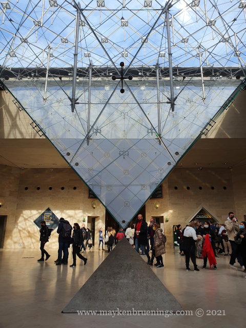
The inverted pyramid is an upside-down version that you can see from the Carrousel du Louvre shopping mall.
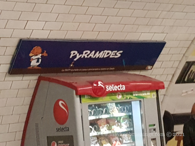
If you want to see the pyramid, don’t get off the métro at the stop Pyramides, however. This metro station is located on Avenue de l’Opéra [link], and the name is a reference to the Battle of the Pyramids of the French army under Napoléon Ier in 1798. Nothing to do with the Louvre pyramid, inaugurated in 1989.
Free Entry Did you know children have free entry to the Louvre Museum? In fact, up to the age of 18, entry is free, and if your country of residence belongs to the European Economic Area (EU, Norway, Iceland, Liechtenstein), it’s even up to 26 years.
The pyramid is also the main entrance to the Louvre museum
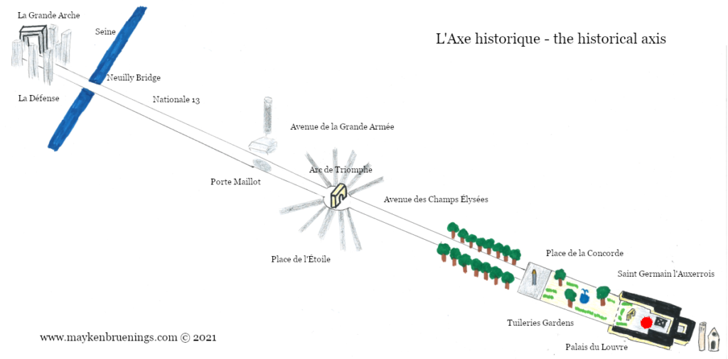
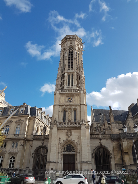
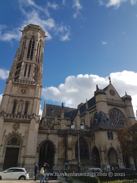
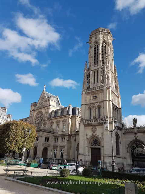
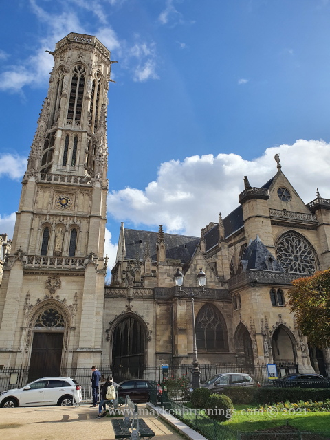
This Roman Catholic church is located in the 1starrondissement, just across the street from the Louvre. Its belfry is the starting point of the axe historique. Saint Germain was the parish church for the inhabitants of the Louvre Palace. Since September 2019, it stands in for the religious services of Notre Dame cathedral.
It is said that the church’s main bell rang in the Saint Bartholonew’s Day massacre on the night of August 23-24, 1572.
The Saint Germain l’Auxerrois church belfry is the starting point of the axe historique
I’m sure you have no trouble spotting the Champs Élysées avenue on a map of Paris. It’s long, large, and straight. Its two end points are easily made out – the Place Charles de Gaulle-Étoile with the Arc de Triomphe on one end, the Place de la Concorde with the Tuileries Gardens and the Louvre on the other. But did you know there’s more to this straight line?
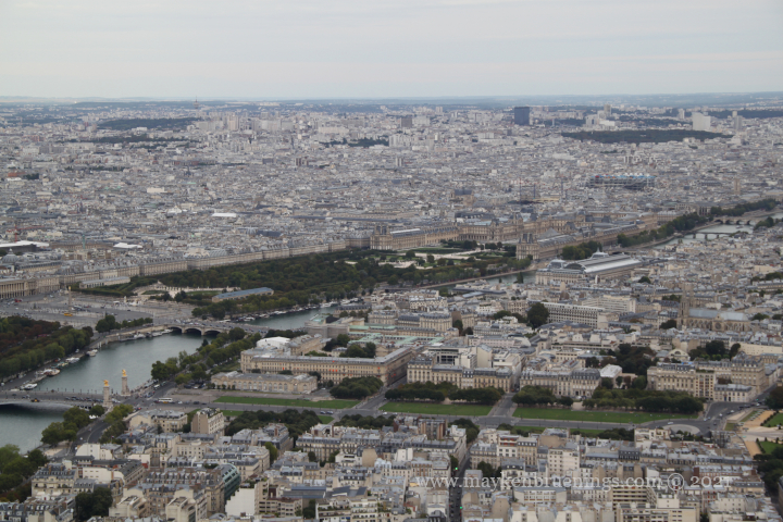
View of Concorde, Tuileries Gardens and Louvre from the Eiffel Tower
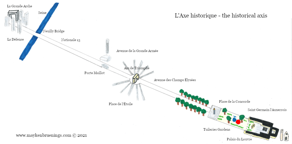
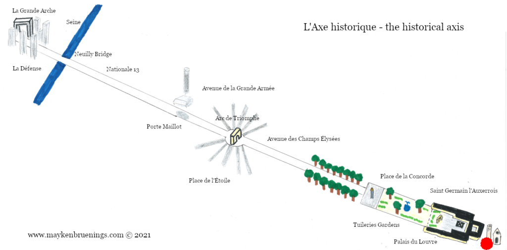
The axe historique (historical axis) or voie triomphale (triumphal way) has a long history that goes back to the 16th century when Catherine de’ Medici, widow of Henry II, had the Tuileries Palace built. The palace burned down during the Commune events, it would be placed between the two “open ends” of the Louvre.
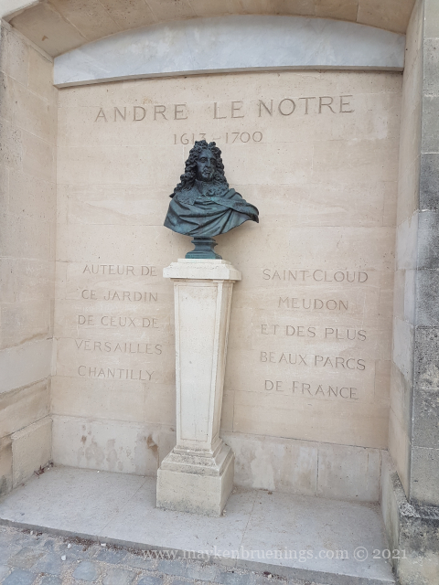
In the 17th century, André Le Nôtre, architect of the Versailles palace gardens, used the royal residence of the Tuileries Palace as reference when he created an avenue running westwards, planning as far as today’s Rond-Point des Champs Élysées.
Today, the axe historique starts at the Louvre, or even at the bell tower of the Saint Germain l’Auxerrois church and ends at the Grande Arche de la Défense.
Let’s explore the axe historique step by step, east to west.
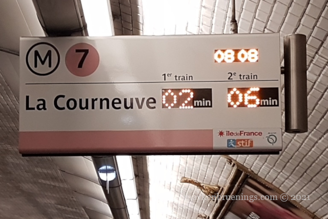
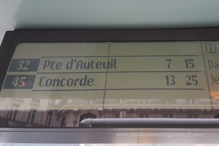
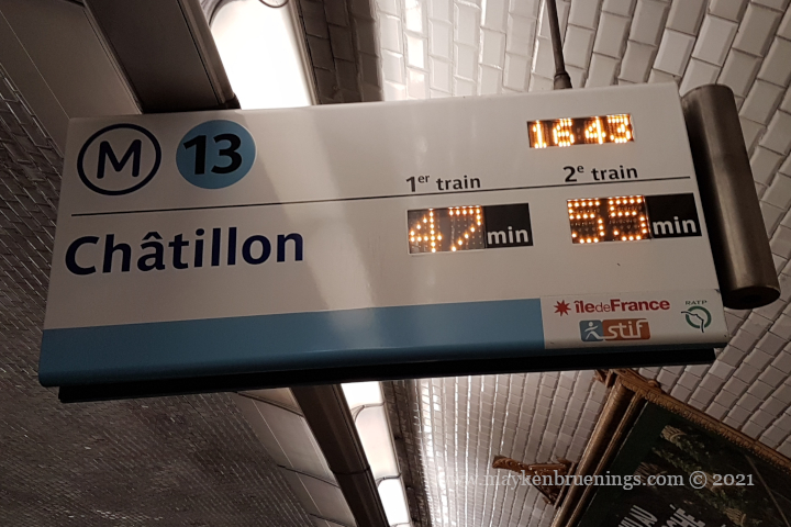
Every city’s transport company has its own system of timetables and of informing travelers when the next bus or train can be expected. In Paris, you raise your eyes to the sky to have the answer. (Unless you check the transport company’s app on your smartphone.)
SIEL on métro 7 northbound
Why the sky? It’s word play. The French word for sky (and heaven, by the way), is ciel. The information system on the Paris public transport is called Système d’information en ligne, acronym SIEL, which is pronounced almost the same as ciel.
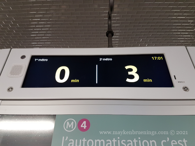
SIEL on recently modernized métro 4
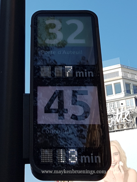
SIEL captures the next two métros or buses in real time, so next time you are at a Paris bus stop or metro station, raise your eyes to the SIEL, it will provide the answer.
SIEL at a bus stopSIEL in a bus shelter
For good measure, here’s one you really don’t want to see:
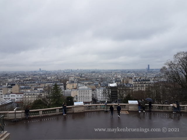
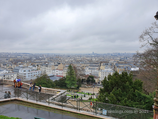
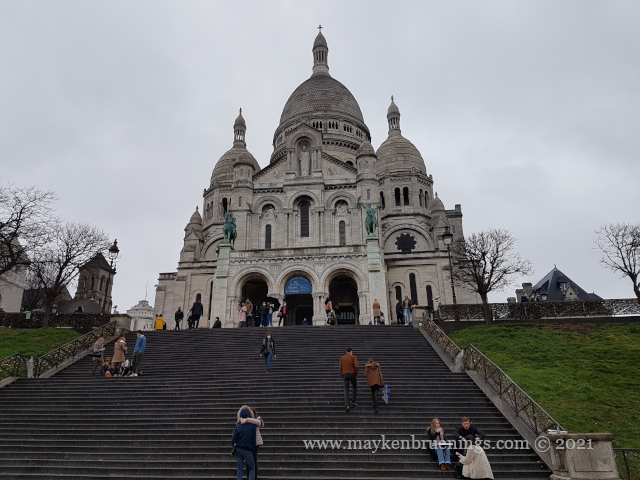
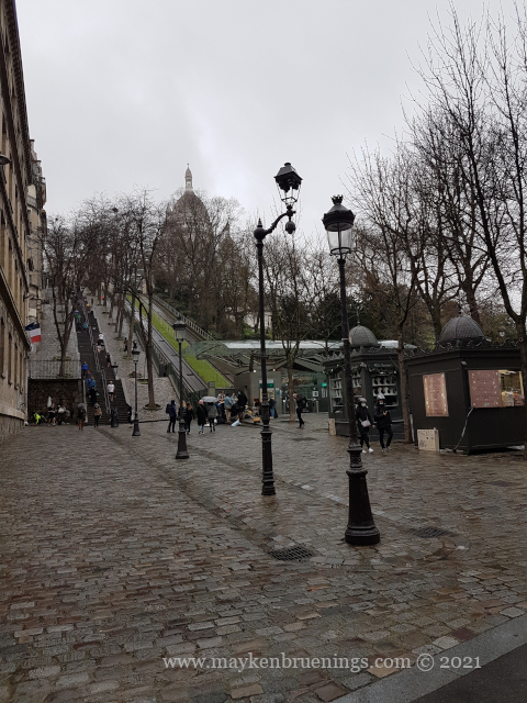
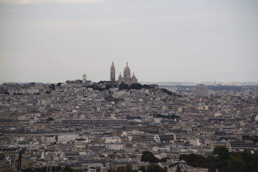
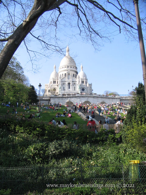
The view from the 130m high hill Butte de Montmartre is quite spectacular.
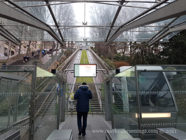
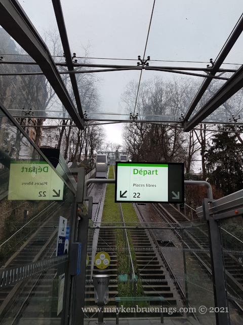
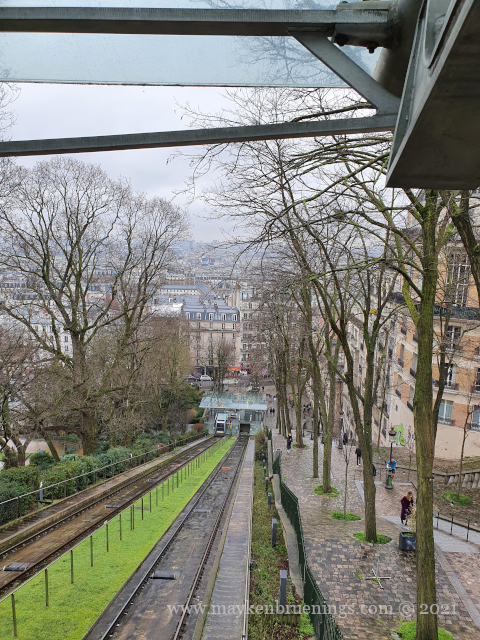
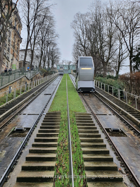
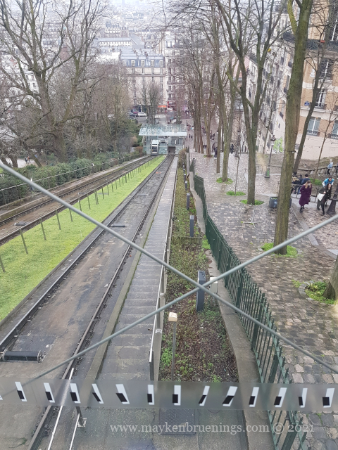
The staircase alongside the funiculaire has 22 stairs.
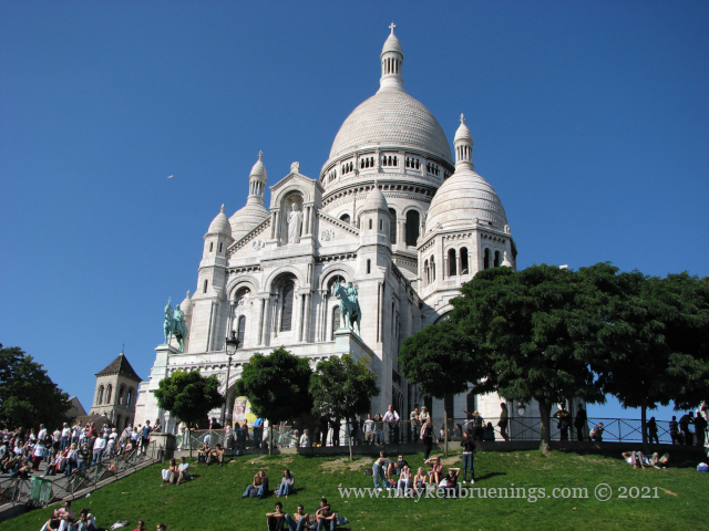
If you dread the stairs leading up to the basilica, you can always take the funiculaire. It’s included in your Paris transport card. The ride only takes a few minutes.
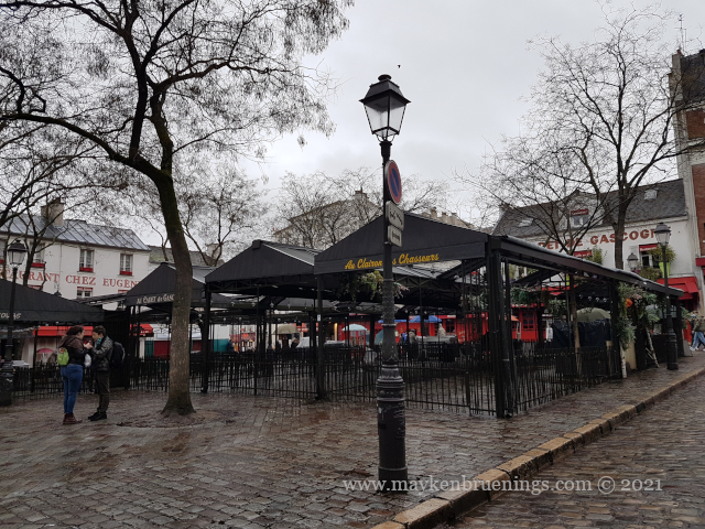
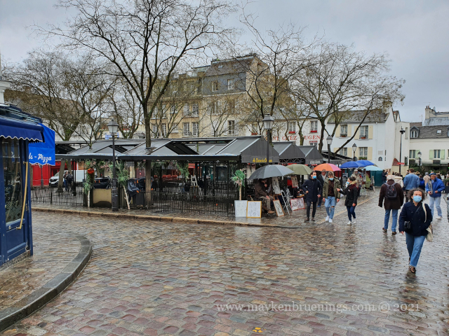
Just around the corner from the Sacré-Cœur, the Place du Tertre awaits with its restaurant terraces and its artists who will happily draw your portrait, realistic or in caricature. (I mentioned this is one of the main tourist attractions, right?)
I might warn you, here as well as anywhere in and around Montmartre, including in the streets leading up from the métro station Pigalle, to watch out for your belongings. Given the crowds, this is pickpocket paradise.
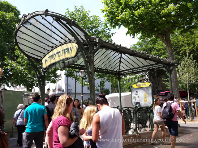
Speaking of metro stations, at which one should you get off for Montmartre? The answer is: it depends.
métro Abbesses
If you want to get to the Sacré-Cœur quickly, hop off the 12 at Abbesses. As the metro runs level but the terrain rises above, Abbesses is way below street level. There’s a long staircases for the adventurous tourists, and elevators for the others. Once you’re outside, it’s a five-minute walk to the funiculaire.
If you want a longer walk up, you can get off the metro 2 or 12 at Pigalle. Just head uphill and watch out for your belongings, and you’ll arrive at Abbesses station.
If you want to head straight for the basilica and are not afraid of tourist traps, get off the 2 at Anvers and you’ll have the Sacré-Cœur in your line of sight. Again, watch for your belongings.
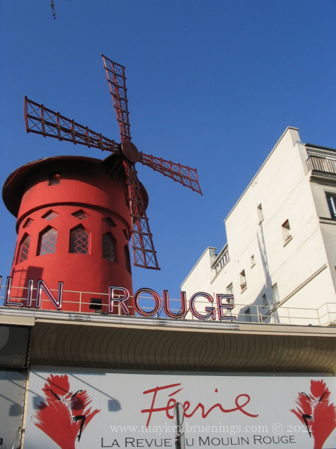
If you want to see the Moulin Rouge first, get off the métro 2 at Blanche. (Then get back on for Pigalle or Anvers.)
How would I go up? I’d get off the 12 at Jules Joffrin or Lamarck-Caulaincourt and take the number 40 bus (it starts at Jules Joffrin, so that’s your better option to get a seat). This bus will take you up the Butte de Montmartre from the back!
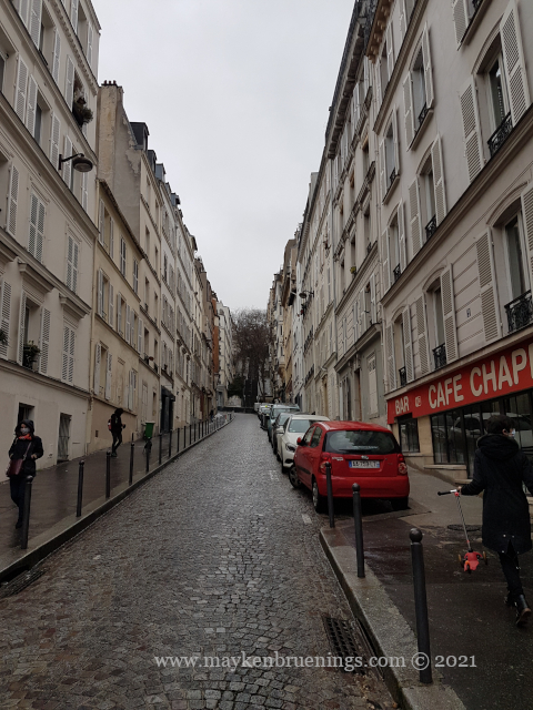
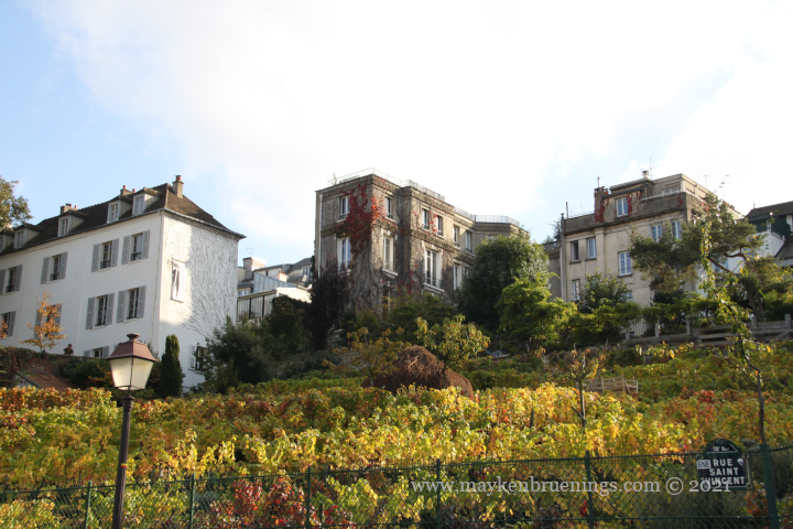
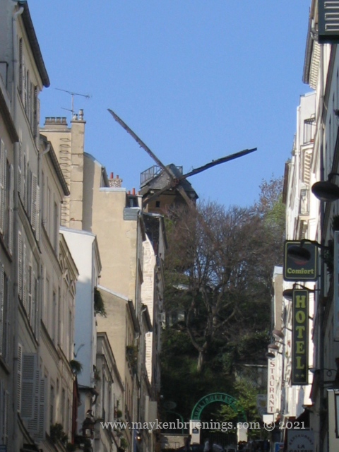
When you’re walking around Montmartre, you’ll be bound to notice one of the windmills. (I’m not talking of the Moulin Rouge!) In the past, there were 13 or more windmills on the hill, of which today only two are left. You can see them both from rue Lepic. The mills served to grind wheat, raisin, plaster and pebbles (for glass production). One even ground iris bulbs for the perfume industry! The windmills inspired the painters who’d come to Montmartre, and you will find them in some of their paintings.
Finally, my personal movie recommendation for an (idealized) Montmartre: Amélie (Le fabuleux destin d’Amélie Poulin).
Montmartre today is one of the most well-known tourist sites of Paris. Its name can be traced back to Gallo-Roman times, when there was a temple dedicated to Mars, the Roman god of War, making the hill mons Martis, the hill of Mars. Or it might come from the hill of martyrs, mons Marthyrum, as Saint Denis and two fellow persecuted Christians were decapitated here.
The hill, called la Butte de Montmartre, is 130m high and constitutes the highest point of Paris.
When France’s municipalities and départements were created following a decree of November 1789, Montmartre became a municipality in the département Seine. It had difficult beginnings, as the recently constructed General Farmers tax wall cut the municipality in two.
When the city of Paris was extended from the General Farmers tax wall to the Adolphe Thiers wall, the municipality of Montmartre was incorporated in the city of Paris and became part of the 18tharrondissement. The small section outside the Thiers wall was incorporated into the municipality of Saint-Ouen.
It is in Montmartre that the revolutionary uprising of the Paris Commune began in 1871 following the lost war against Prussia., sparked by the attempt of the newly formed Third French Republic’s government to recover a large number of canons the French army had stored on the hill during the Franco-Prussian War.
During the 19th and 20th century, Montmartre attracted numerous painters, such as Picasso, Toulouse-Lautrec, Van Gogh, or Modigliani.
The Sacré Cœur (Holy Heart) Basilica was built after the Franco-Prussian war and represents a national penance both for the actions of the Paris Commune and the French defeat in the war. The construction was financed entirely by private donations. Inside the basilica, you can see stones with names of donors engraved.
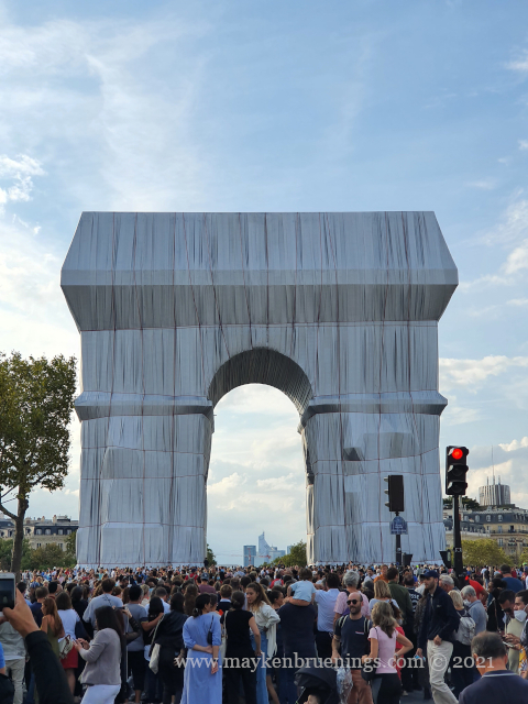
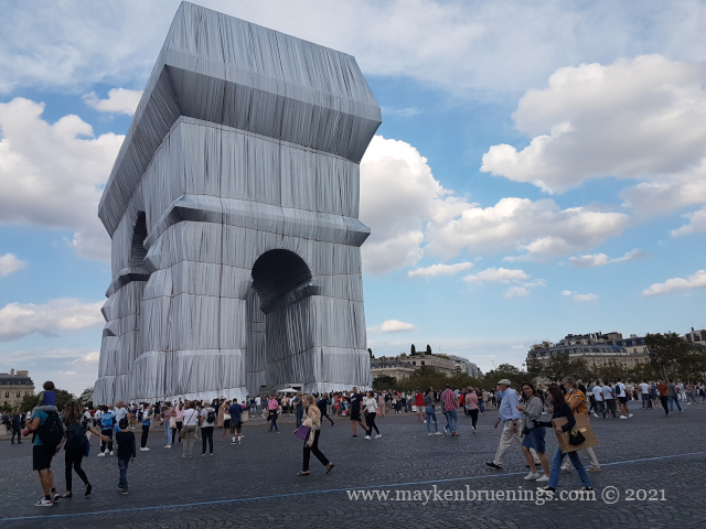
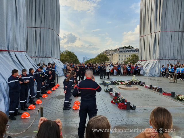
For two weeks, from September 18 to October 3rd, 2021, the Arc de Triomphe monument was wrapped by Christo and Jeanne-Claude (posthumously, as Jeanne-Claude died in 2009 and Christo, in 2020). Christo and Jeanne-Claude wrapped up several of well-known monuments all over the world, the Pont-Neuf (1985) among them as well as the Reichstag in Berlin (1995).
The Arc de Triomphe, however, had a special meaning for them, as Paris is the place where they first met. They started planning their Arc de Triomphe project in 1961, so yes, it was 60 years in the making.
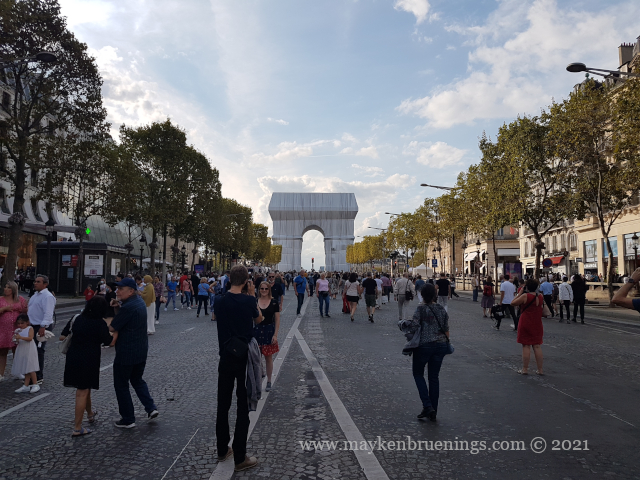
The Place de l’Étoile at the center of which thrones the Arc de Triomphe, is a giant roundabout where no fewer than twelve avenues meet. If you look at it from above and zoom in, you will see there are triangles on the road surface making it effectively look like a star (étoile in French).
During the opening weekend of the Wrapped exhibition, all twelve avenues were closed off, and the roundabout was open to pedestrians. It was possible not only to approach the artwork but to actually touch it.
Meanwhile, veteran associations watched over the eternal flame below the Arc and the daily ceremony of relighting the flame continued.
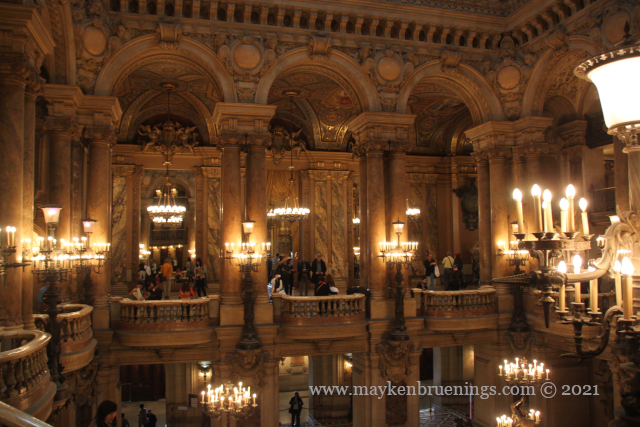
One Friday night when I was marshal at the Paris inline skate, I chatted with some tourists while guarding an intersection on the Avenue de l’Opéra. The tourists were from the U.S., and I told them that the opera building they could see at the end of the avenue was indeed the one with the phantom and the underground lake.
There are many tales about the phantom and how a real person might have inspired Gaston Laroux’ story (which became the basis for Andrew Llyod Webber’s musical), but the lake is real.
Remember the problem with the high groundwater level I mentioned in my previous post?
The building site was swampy, and water rising from below hampered the construction until finally, they encased the “lake” and used the weight of the water in the foundation of the building. The cistern remains accessible, but you can’t take a boat to row across it. However, the Paris fire-fighters use it for diving training.
But the phantom? A combination of mysterious noises during the first shows, rumors about an underground lake and the never fully explained accident in 1896, when the counterweight of the chandelier fell down and killed the concierge.
Box number five is still reserved for the phantom, as the Opéra Garnier itself confirmed in a Museum Week tweet a few years ago: